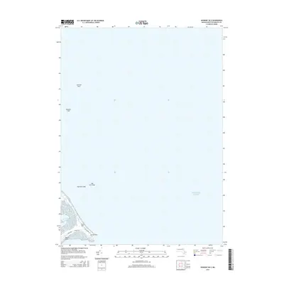
2015 Map of Duxbury OE E
USGS Topo · Published 2015About this map
Gurnet Point and the narrow coastal peninsula of Saquish Beach dominate this 2015 maritime survey at the edge of the Atlantic Ocean. The map documents a fragile landscape of sand and sea, where local roads like Boulevard, Central Ave, and King Arthur Rd serve the small cluster of shoreline development. To the north, the terrain gives way to the sea-bound Plum Hills before disappearing into the open water. Submerged hazards and landmarks important to coastal navigation are clearly identified, including Farnham Rock, Howland Ledge, and High Pine Ledge. This map provides a clear view of the modern infrastructure and natural features along this specific stretch of the Plymouth coast, serving as a detailed record of the peninsula's geography before ongoing coastal erosion and rising sea levels further alter the shoreline.
Find a feature on this map
10 named features on this map. Tap any name to fly to it.
Don’t see what you’re looking for? This feature index may not catch every label — zoom into the map to look around manually.
Map Details
Editions of this 2015 Duxbury OE E Map
This is the sole edition of this map. No revisions or reprints were ever made.
Other maps of this area

1885 · Duxbury
USGS Topo · 1:62,500

1886 · Plymouth
USGS Topo · 1:62,500

1888 · Duxbury
USGS Topo · 1:62,500

1889 · Plymouth
USGS Topo · 1:62,500

1893 · Duxbury
USGS Topo · 1:62,500

1894 · Plymouth
USGS Topo · 1:62,500

1918 · Duxbury
USGS Topo · 1:62,500
1921 · Plymouth
USGS Topo · 1:62,500
1934 · Plymouth
USGS Topo · 1:24,000
1935 · Scituate
USGS Topo · 1:24,000