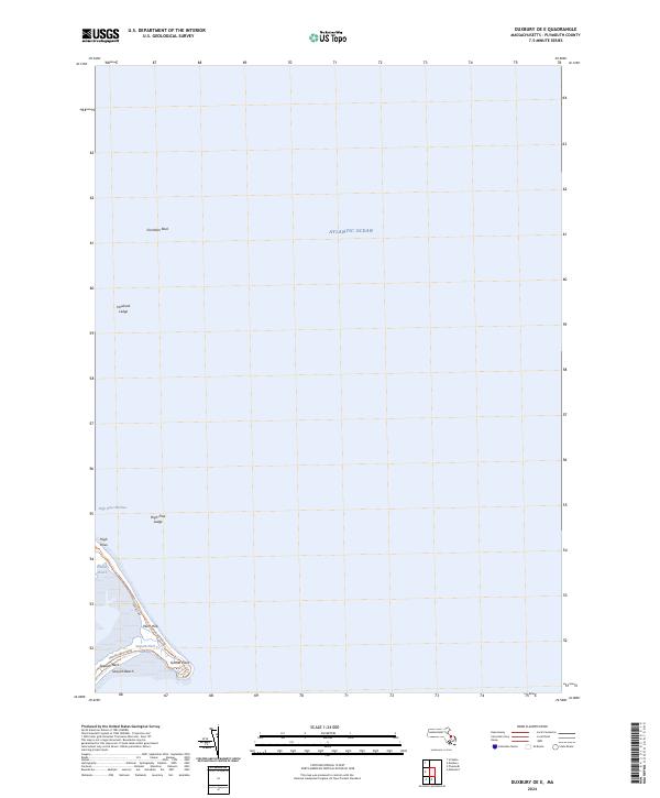
2024 Map of Duxbury OE E
USGS Topo · Published 2024About this map
The coastal peninsula of Saquish Neck and the slender reach of Duxbury Beach define this maritime study of the Plymouth coast. This environment is characterized by shifting sands and low-lying marshes, where Saquish Neck Marshes and High Pines Marshes transition into the expansive Atlantic Ocean. The map documents a fragile landscape of dunes and tidal areas, anchored by small topographic rises such as Plum Hills and the prominent Gurnet Point at the southernmost tip.
Find a feature on this map
15 named features on this map. Tap any name to fly to it.
Don’t see what you’re looking for? This feature index may not catch every label — zoom into the map to look around manually.
Map Details
Editions of this 2024 Duxbury OE E Map
This is the sole edition of this map. No revisions or reprints were ever made.
Other maps of this area

1885 · Duxbury
USGS Topo · 1:62,500

1886 · Plymouth
USGS Topo · 1:62,500

1888 · Duxbury
USGS Topo · 1:62,500

1889 · Plymouth
USGS Topo · 1:62,500

1893 · Duxbury
USGS Topo · 1:62,500

1894 · Plymouth
USGS Topo · 1:62,500

1918 · Duxbury
USGS Topo · 1:62,500
1921 · Plymouth
USGS Topo · 1:62,500
1934 · Plymouth
USGS Topo · 1:24,000
1935 · Scituate
USGS Topo · 1:24,000