2024 Map of Eagle
USGS Topo · Published 2024About this map
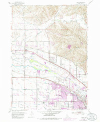
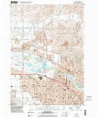
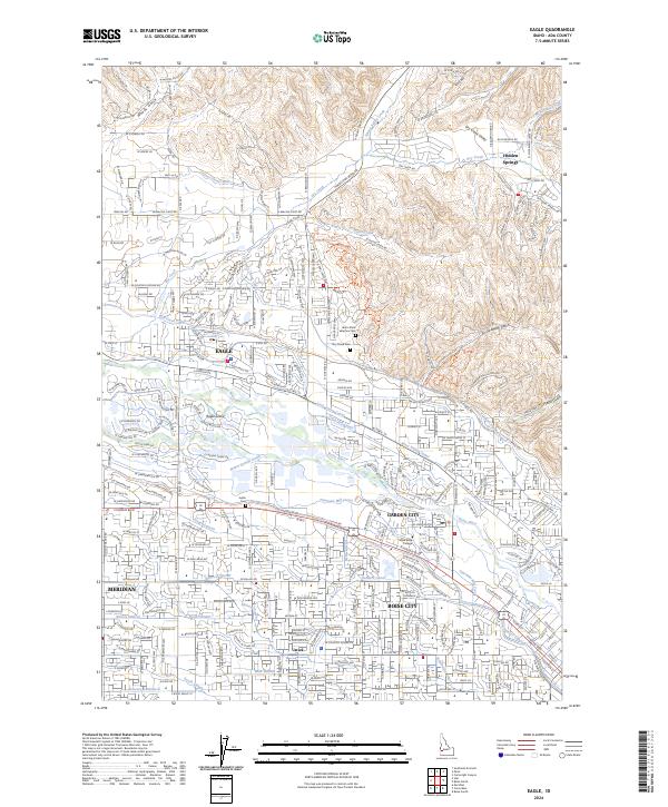
Eagle and the surrounding Treasure Valley landscape are defined by a complex network of irrigation infrastructure and river morphology. The Boise River splits to form the prominent Eagle Island, which contains the Eagle Island Cem, while a system of historic waterways like the Settlers Canal, Thurman Mill Canal, and Boise Valley Canal distribute water across the valley floor. This intricate engineering supports the growth of communities such as Garden City and Meridian, bridging the gap between the modern city limits of Boise City and the rising foothills to the north.
Find a feature on this map
148 named features on this map. Tap any name to fly to it.
Don’t see what you’re looking for? This feature index may not catch every label — zoom into the map to look around manually.
Map Details
Editions of this 2024 Eagle Map
This is the sole edition of this map. No revisions or reprints were ever made.