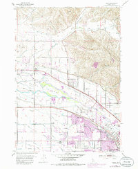
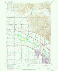
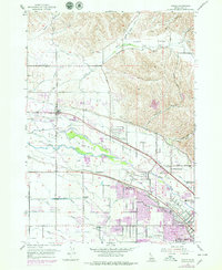
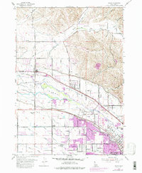
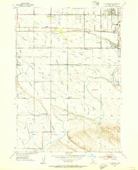
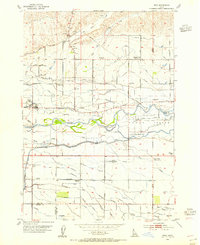
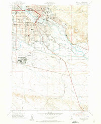
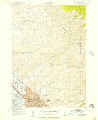
1953 Map of Eagle
USGS Topo · Published 1986About this map
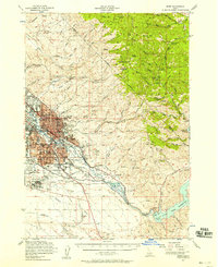
The Boise River splits into distinct channels as it moves westward, creating the large Eagle Island and a complex network of agricultural irrigation. In the mid-twentieth century, this landscape was defined by its water management systems, including the Farmers Union Canal, Warm Springs Canal, and Settlers Canal. While the town of Eagle and the developing outskirts of Garden City show early signs of urban expansion, the surrounding terrain remained largely rural.
Find a feature on this map
55 named features on this map. Tap any name to fly to it.
Don’t see what you’re looking for? This feature index may not catch every label — zoom into the map to look around manually.
Map Details
Editions of this 1953 Eagle Map
5 editions found
Other maps of this area

1892 · Boise
USGS Topo · 1:125,000

1897 · Boise
USGS Topo · 1:125,000

1953 · Eagle
USGS Topo · 1:24,000
1953 · Cloverdale
USGS Topo · 1:24,000

1953 · Meridian
USGS Topo · 1:24,000
1953 · Star
USGS Topo · 1:24,000

1953 · Montour
USGS Topo · 1:62,500
1954 · Boise South
USGS Topo · 1:24,000
1954 · Boise North
USGS Topo · 1:24,000
1954 · Boise
USGS Topo · 1:62,500