
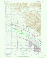
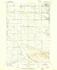
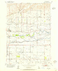
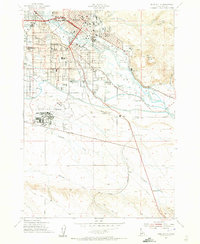
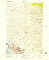
1953 Map of Eagle
USGS Topo · Published 1955About this map
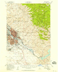
The Boise River splits and converges to form the large landmass of Eagle Island, a central feature of this Idaho landscape during the early 1950s. The agricultural character of the era is evidenced by a complex network of irrigation infrastructure, including the Ballentine Canal, Capitol View Canal, and Little Dry Creek Canal. These waterworks supported the scattered homesteads and dairy farms that defined the region before suburban expansion took hold. Local community life is anchored by landmarks such as McMillan Chapel and the Jopin Cem, while several educational buildings are already noted as out of use, including White Cross School and Valley View Sch. Aviation activity is surprisingly prominent with Floating Feather Airport, Bradley Field, and a Major Airport all situated near the river's winding course.
Find a feature on this map
61 named features on this map. Tap any name to fly to it.
Don’t see what you’re looking for? This feature index may not catch every label — zoom into the map to look around manually.
Map Details
Editions of this 1953 Eagle Map
5 editions found
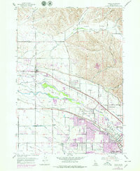
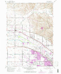
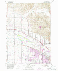
Other maps of this area

1892 · Boise
USGS Topo · 1:125,000

1897 · Boise
USGS Topo · 1:125,000
1953 · Cloverdale
USGS Topo · 1:24,000

1953 · Meridian
USGS Topo · 1:24,000
1953 · Star
USGS Topo · 1:24,000

1953 · Montour
USGS Topo · 1:62,500
1954 · Boise South
USGS Topo · 1:24,000
1954 · Boise North
USGS Topo · 1:24,000
1954 · Boise
USGS Topo · 1:62,500

1955 · Boise
USGS Topo · 1:250,000