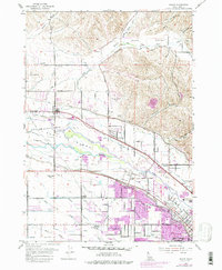
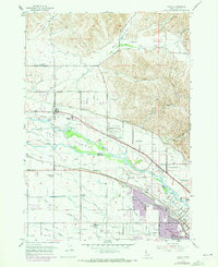
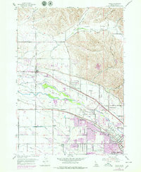
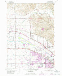
1953 Map of Eagle
USGS Topo · Published 1986About this map
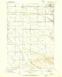
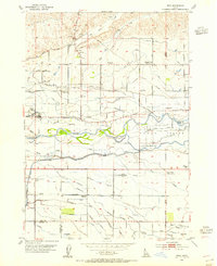
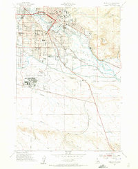
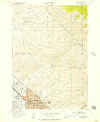
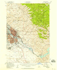
Eagle Island sits at the heart of this Idaho landscape, defined by the intricate bifurcations of the Boise River. The 1953 topography reveals a transition from traditional agricultural life to early suburban expansion, particularly around Ustick and the northern reaches of Garden City. A sophisticated network of irrigation, including the Farmers Union Canal and Boise Valley Canal, illustrates the engineering required to sustain this valley's homesteads. The map captures a moment when several local institutions were falling into disuse, as evidenced by the labels for Green Meadows Sch, White Cross School, and Valley View Sch. From the Floating Feather Airport to the family-named roads like Mason-Catlin Road and Thurman Mill Road, the sheet provides a detailed view of the Boise Valley's mid-century rural-urban fringe.
Find a feature on this map
53 named features on this map. Tap any name to fly to it.
Don’t see what you’re looking for? This feature index may not catch every label — zoom into the map to look around manually.
Map Details
Editions of this 1953 Eagle Map
5 editions found
Other maps of this area

1892 · Boise
USGS Topo · 1:125,000

1897 · Boise
USGS Topo · 1:125,000

1953 · Eagle
USGS Topo · 1:24,000
1953 · Cloverdale
USGS Topo · 1:24,000

1953 · Meridian
USGS Topo · 1:24,000
1953 · Star
USGS Topo · 1:24,000

1953 · Montour
USGS Topo · 1:62,500
1954 · Boise South
USGS Topo · 1:24,000
1954 · Boise North
USGS Topo · 1:24,000
1954 · Boise
USGS Topo · 1:62,500