1953 Map of Eagle
USGS Topo · Published 1973About this map
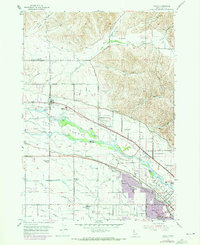
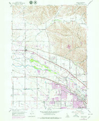
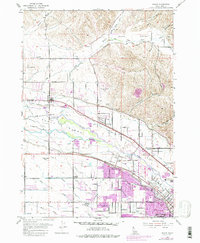
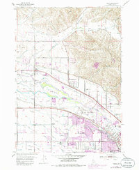
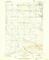
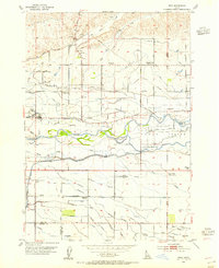
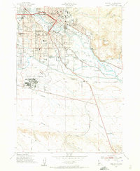
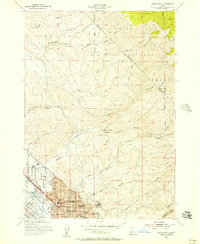
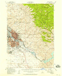
Boise River and Little Boise River define this agricultural corridor north of Boise, where a complex network of irrigation projects like the Settlers Canal and Thurman Mill Canal turned the arid valley into productive farmland. The landscape reveals a transition from rural life to suburban expansion, featuring early landmarks such as the Jodin Cem and McMillan Chapel alongside the former sites of the White Cross School and Valley View Sch. The southern edge of the survey captures the fringe of Boise and Garden City, including the Western Idaho Fairgrounds and Bradley Field. Further north, aviation history is represented by the Floating Feather Airport near Dry Creek Valley. The purple revisions reflect the rapid growth around Eagle and Green Meadows in the early 1970s, as new roads and housing began to overtake the historic canals and orchards.
Find a feature on this map
80 named features on this map. Tap any name to fly to it.
Don’t see what you’re looking for? This feature index may not catch every label — zoom into the map to look around manually.
Map Details
Editions of this 1953 Eagle Map
5 editions found
Other maps of this area

1892 · Boise
USGS Topo · 1:125,000

1897 · Boise
USGS Topo · 1:125,000

1953 · Eagle
USGS Topo · 1:24,000
1953 · Cloverdale
USGS Topo · 1:24,000

1953 · Meridian
USGS Topo · 1:24,000
1953 · Star
USGS Topo · 1:24,000

1953 · Montour
USGS Topo · 1:62,500
1954 · Boise South
USGS Topo · 1:24,000
1954 · Boise North
USGS Topo · 1:24,000
1954 · Boise
USGS Topo · 1:62,500