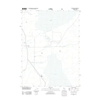
2012 Map of Eagleville
USGS Topo · Published 2012About this map
Eagleville and its surrounding ranchlands occupy this transition between the Warner Mountains and the vast playa basins of Surprise Valley. The landscape is defined by the hydrologic contrast between the arid lakebeds of Middle Alkali Lake and Lower Lake and the perennial streams like Raider Cr and Eagle Cr that descend from the high ground to the west. This 2012 survey illustrates a dispersed settlement pattern centered on legacy agricultural operations, including Cockrell Ranch, Midra Ranch, and Mount Stevenson Ranch. Local infrastructure is anchored by the Eagleville Cem and the small Eagleville Airport, while the presence of Menlo Baths suggests the geothermal activity characteristic of the region. The map details the local transportation network, highlighting the Eagleville Loop and Hays Canyon Rd as primary routes through this remote northeastern California community.
Find a feature on this map
20 named features on this map. Tap any name to fly to it.
Don’t see what you’re looking for? This feature index may not catch every label — zoom into the map to look around manually.
Map Details
Editions of this 2012 Eagleville Map
This is the sole edition of this map. No revisions or reprints were ever made.
Other maps of this area

1886 · Alturas
USGS Topo · 1:250,000

1889 · Long Valley
USGS Topo · 1:250,000

1892 · Alturas
USGS Topo · 1:250,000

1954 · Vya
USGS Topo · 1:250,000

1954 · Alturas
USGS Topo · 1:250,000

1958 · Alturas
USGS Topo · 1:250,000

1958 · Vya
USGS Topo · 1:250,000

1962 · Alturas
USGS Topo · 1:250,000

1962 · Vya
USGS Topo · 1:250,000

1962 · Snake Lake
USGS Topo · 1:24,000