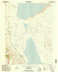
1993 Map of Eagleville
USGS Topo · Published 1996About this map
The settlement of Eagleville serves as the focal point of this arid valley landscape on the edge of the Modoc National Forest. Situated in the Surprise Valley, the community is surrounded by family-operated agricultural sites like Cockrell Ranch, Mt Stevenson Ranch, and Midra Ranch. The presence of Eagleville Cem provides a tangible point of interest for genealogists tracing early families in this corner of Modoc County.
Find a feature on this map
32 named features on this map. Tap any name to fly to it.
Don’t see what you’re looking for? This feature index may not catch every label — zoom into the map to look around manually.
Map Details
Editions of this 1993 Eagleville Map
This is the sole edition of this map. No revisions or reprints were ever made.
Other maps of this area

1886 · Alturas
USGS Topo · 1:250,000

1889 · Long Valley
USGS Topo · 1:250,000

1892 · Alturas
USGS Topo · 1:250,000

1954 · Vya
USGS Topo · 1:250,000

1954 · Alturas
USGS Topo · 1:250,000

1958 · Alturas
USGS Topo · 1:250,000

1958 · Vya
USGS Topo · 1:250,000

1962 · Alturas
USGS Topo · 1:250,000

1962 · Vya
USGS Topo · 1:250,000

1962 · Snake Lake
USGS Topo · 1:24,000