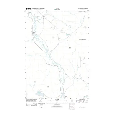
2011 Map of East Andover
USGS Topo · Published 2011About this map
The Ellis River snakes through this Oxford County landscape, creating a broad valley floor between the heights of Farmers Hill and Whitecap Mountain. This 2011 survey documents the rural character of the region, where the settlements of South Andover and East Andover are linked by a network of local roads and numerous fire lanes. A significant cultural landmark, the Lovejoy Bridge, sits near the river's edge, while the northeastern corner of the map features the Black Mountain of Maine Ski Area. Genealogists will find a high density of burial sites along the river corridor, including the Upper West Ellis Cemetery, Lower West Ellis Cemetery, and East Ellis Cemetery. The southern reaches of the map terminate at Rumford Point near the confluence with the Androscoggin River.
Find a feature on this map
55 named features on this map. Tap any name to fly to it.
Don’t see what you’re looking for? This feature index may not catch every label — zoom into the map to look around manually.
Map Details
Editions of this 2011 East Andover Map
This is the sole edition of this map. No revisions or reprints were ever made.
Other maps of this area

1911 · Bryant Pond
USGS Topo · 1:62,500

1914 · Bethel
USGS Topo · 1:62,500

1914 · Bryant Pond
USGS Topo · 1:62,500

1927 · Rumford
USGS Topo · 1:48,000

1930 · Rumford
USGS Topo · 1:62,500

1940 · Bethel
USGS Topo · 1:62,500

1941 · Bethel
USGS Topo · 1:62,500

1942 · Bryant Pond
USGS Topo · 1:62,500

1943 · Old Speck Mtn
USGS Topo · 1:62,500

1945 · Old Speck Mtn
USGS Topo · 1:62,500