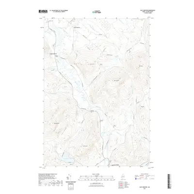
2021 Map of East Andover
USGS Topo · Published 2021About this map
The Ellis River valley serves as the central artery of this Oxford County landscape, where the settlements of East Andover and South Andover are established along the river's meandering course. Historically significant river crossings are evidenced by the presence of the Lovejoy Bridge near the junction of S Main St and Covered Bridge Rd. The map records a dense network of local cemeteries including Farmers Hill Cem, Upper West Ellis Cem, and Lower West Ellis Cem, providing invaluable data for genealogists tracking early families in the valley. High-elevation terrain like Whitecap Mtn and Plumbago Mtn define the western and central horizons, while the southern edge of the sheet reaches the Androscoggin River at Rumford Point. This modern survey reveals a landscape where old farm roads like Swain Farm Rd and Farmers Hill Rd still navigate the complex topography of the western Maine uplands.
Find a feature on this map
61 named features on this map. Tap any name to fly to it.
Don’t see what you’re looking for? This feature index may not catch every label — zoom into the map to look around manually.
Map Details
Editions of this 2021 East Andover Map
This is the sole edition of this map. No revisions or reprints were ever made.
Other maps of this area

1911 · Bryant Pond
USGS Topo · 1:62,500

1914 · Bethel
USGS Topo · 1:62,500

1914 · Bryant Pond
USGS Topo · 1:62,500

1927 · Rumford
USGS Topo · 1:48,000

1930 · Rumford
USGS Topo · 1:62,500

1940 · Bethel
USGS Topo · 1:62,500

1941 · Bethel
USGS Topo · 1:62,500

1942 · Bryant Pond
USGS Topo · 1:62,500

1943 · Old Speck Mtn
USGS Topo · 1:62,500

1945 · Old Speck Mtn
USGS Topo · 1:62,500