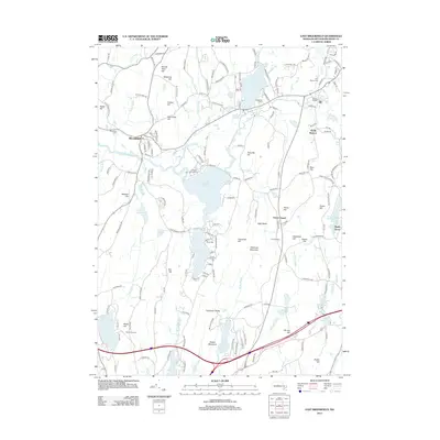
2012 Map of East Brookfield
USGS Topo · Published 2012About this map
The Quaboag River and its expansive wetlands anchor this Worcester County landscape, winding through a chain of glacial water bodies including Quaboag Pond and Quacumquasit Pond. The terrain is characterized by numerous named summits such as Hitchcock Mountain and Foster Hill, reflecting the complex topography of central Massachusetts. In the northern reaches, Lake Lashaway and the surrounding settlement of Brookfield show a concentration of local infrastructure, including the Brookfield Cem and Holy Rosary Cem. Further south, the map documents a mix of agricultural and recreational land use, from Hyland Orchard near Alum Pond to the Lakeside Campground. Significant elevation points like Carpenter Rocks and Walker Mountain overlook a network of brooks, such as Hobbs Brook and McKinstry Brook, which drain the varied upland heights towards the primary river valley.
Find a feature on this map
171 named features on this map. Tap any name to fly to it.
Don’t see what you’re looking for? This feature index may not catch every label — zoom into the map to look around manually.
Map Details
Editions of this 2012 East Brookfield Map
This is the sole edition of this map. No revisions or reprints were ever made.
Other maps of this area

1885 · Worcester
USGS Topo · 1:62,500

1886 · Worcester
USGS Topo · 1:62,500

1887 · Brookfield
USGS Topo · 1:62,500

1887 · Barre
USGS Topo · 1:62,500

1889 · Webster
USGS Topo · 1:62,500

1889 · Barre
USGS Topo · 1:62,500

1890 · Brookfield
USGS Topo · 1:62,500

1892 · Webster
USGS Topo · 1:62,500

1892 · Worcester
USGS Topo · 1:62,500

1893 · Brookfield
USGS Topo · 1:62,500