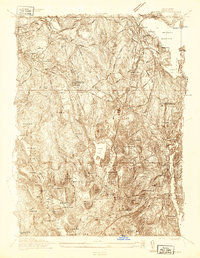
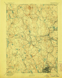
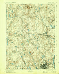
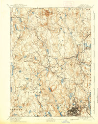
1892 Map of Worcester
USGS Topo · Published 1892About this map
Wachusett Mt dominates the northern horizon of this late nineteenth-century landscape, a region defined by its numerous hills and a complex network of waterways feeding into the Nashua River and Ware River. The topography is densely marked with family and place-named heights like Asnebumskit Hill and Little Wachusett, reflecting a deeply settled rural interior. In the south, the burgeoning city of Worcester shows its early industrial footprint, including the prominent State Lunatic Hospital and the neighborhood of Tatnuck.
Find a feature on this map
141 named features on this map. Tap any name to fly to it.
Don’t see what you’re looking for? This feature index may not catch every label — zoom into the map to look around manually.
Map Details
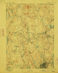
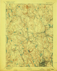
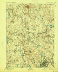
Editions of this 1892 Worcester Map
10 editions found
1892 edition
15.8 x 19.6 inches
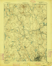
1897 edition
15.8 x 20.1 inches
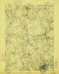
1899 edition
15.8 x 19.7 inches
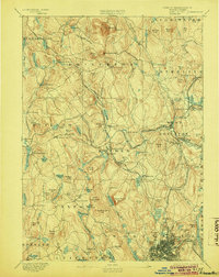
1904 edition
15.8 x 19.8 inches
1906 edition
15.8 x 19.8 inches
1912 edition
15.8 x 19.7 inches
1917 edition
15.7 x 19.7 inches
1924 edition
15.8 x 19.8 inches
1932 edition
15.8 x 19.8 inches
1939 edition
15.8 x 19.9 inches
Historical Maps of Worcester Through Time
4 maps found