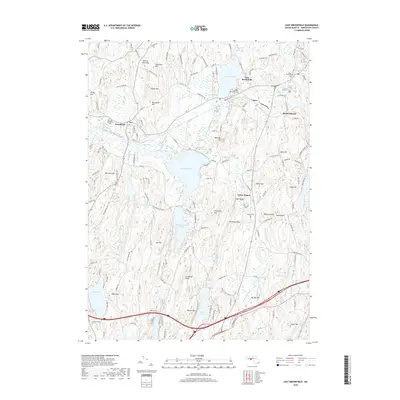
2018 Map of East Brookfield
USGS Topo · Published 2018About this map
East Brookfield and the surrounding Worcester County landscape are defined by a complex network of glacial ponds and wetlands that have historically shaped local settlement and travel. The Quaboag River flows through the center of the sheet, connecting Lake Lashaway and Quaboag Pond amidst the Great Swamp. This 2018 survey details the transition from traditional village centers to modern transportation corridors, with significant elevation markers like Walker Mtn and Hitchcock Mtn overlooking the valley. Local family history and burial records are well-represented by several grounds including Brookfield Cem, Evergreen Cem, and the uniquely named Podunk Cem. The presence of Claypit Pond serves as a reminder of earlier industrial activities in the region, while the inclusion of Union Chapel and small settlements like South Spencer provides a clear view of the area's social geography.
Find a feature on this map
61 named features on this map. Tap any name to fly to it.
Don’t see what you’re looking for? This feature index may not catch every label — zoom into the map to look around manually.
Map Details
Editions of this 2018 East Brookfield Map
This is the sole edition of this map. No revisions or reprints were ever made.
Other maps of this area

1885 · Worcester
USGS Topo · 1:62,500

1886 · Worcester
USGS Topo · 1:62,500

1887 · Brookfield
USGS Topo · 1:62,500

1887 · Barre
USGS Topo · 1:62,500

1889 · Webster
USGS Topo · 1:62,500

1889 · Barre
USGS Topo · 1:62,500

1890 · Brookfield
USGS Topo · 1:62,500

1892 · Webster
USGS Topo · 1:62,500

1892 · Worcester
USGS Topo · 1:62,500

1893 · Brookfield
USGS Topo · 1:62,500