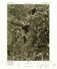
1975 Map of East Brookfield
USGS Topo · Published 1981About this map
Quaboag Pond and Quacumquasit Pond dominate the central landscape of this mid-1970s orthophotograph, illustrating the water-rich geography of central Worcester County. The settlement pattern is defined by the historic hubs of Brookfield, East Brookfield, and the southwestern edge of Spencer. The intricate drainage system is clearly visible, with the Fivemile River and Sevenmile River feeding into the basin near the small community of Mystic Grove. This aerial perspective, captured on October 23, 1975, reveals the transition between concentrated village centers and the surrounding agricultural and wooded tracts. The winding course of the Quaboag River and the East Brookfield River highlights the natural corridors that historically dictated local development and transport in this part of Massachusetts.
Find a feature on this map
10 named features on this map. Tap any name to fly to it.
Don’t see what you’re looking for? This feature index may not catch every label — zoom into the map to look around manually.
Map Details
Editions of this 1975 East Brookfield Map
This is the sole edition of this map. No revisions or reprints were ever made.
Other maps of this area

1885 · Worcester
USGS Topo · 1:62,500

1886 · Worcester
USGS Topo · 1:62,500

1887 · Brookfield
USGS Topo · 1:62,500

1887 · Barre
USGS Topo · 1:62,500

1889 · Webster
USGS Topo · 1:62,500

1889 · Barre
USGS Topo · 1:62,500

1890 · Brookfield
USGS Topo · 1:62,500

1892 · Webster
USGS Topo · 1:62,500

1892 · Worcester
USGS Topo · 1:62,500

1893 · Brookfield
USGS Topo · 1:62,500