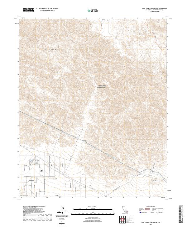
2021 Map of East Deception Canyon
USGS Topo · Published 2021About this map
The Little San Bernardino Mountains dominate the northern terrain of this map, giving way to the sprawling desert floor where the settlement of Sky Valley and the area of Fun Valley are established. This 2021 survey highlights the transition from the high, arid peaks of Joshua Tree National Park down through the drainage systems of West Deception Canyon and East Deception Canyon. A critical piece of regional infrastructure, the Colorado River Aqueduct, cuts across the lower elevation, demonstrating the engineering required to sustain life in this arid landscape. The map also traces the California Riding and Hiking Trl as it winds through the northeast corner, providing a detailed record of recreation and water management systems at the edge of the Indio Hills. Local roads like Dillon Rd and Sky Ridge Ave define the residential grid of the valley floor below the high ridges of Upper Covington Flat.
Find a feature on this map
50 named features on this map. Tap any name to fly to it.
Don’t see what you’re looking for? This feature index may not catch every label — zoom into the map to look around manually.
Map Details
Editions of this 2021 East Deception Canyon Map
This is the sole edition of this map. No revisions or reprints were ever made.
Other maps of this area

1941 · Edom
USGS Topo · 1:62,500

1944 · Edom
USGS Topo · 1:62,500

1944 · Pinyon Well
USGS Topo · 1:62,500

1947 · Santa Ana
USGS Topo · 1:250,000

1949 · Santa Ana
USGS Topo · 1:250,000

1953 · San Bernardino
USGS Topo · 1:250,000

1955 · Twentynine Palms
USGS Topo · 1:62,500

1955 · Joshua Tree
USGS Topo · 1:62,500

1956 · San Bernardino
USGS Topo · 1:250,000

1956 · Santa Ana
USGS Topo · 1:250,000