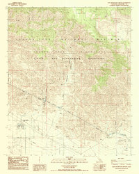
1988 Map of East Deception Canyon
USGS Topo · Published 1988About this map
The Little San Bernardino Mountains dominate this high-desert landscape, where steep ridgelines descend into the distinct drainages of East Deception Canyon and West Deception Canyon. The 1980s terrain reveals a complex intersection of preservation and infrastructure, as the Joshua Tree National Monument boundary meets the critical path of the Colorado River Aqueduct. This massive engineering feat is visible as it traverses the southern slopes, including a mapped Siphon near Fan Hill.
Find a feature on this map
20 named features on this map. Tap any name to fly to it.
Don’t see what you’re looking for? This feature index may not catch every label — zoom into the map to look around manually.
Map Details
Editions of this 1988 East Deception Canyon Map
This is the sole edition of this map. No revisions or reprints were ever made.
Other maps of this area

1941 · Edom
USGS Topo · 1:62,500

1944 · Edom
USGS Topo · 1:62,500

1944 · Pinyon Well
USGS Topo · 1:62,500

1947 · Santa Ana
USGS Topo · 1:250,000

1949 · Santa Ana
USGS Topo · 1:250,000

1953 · San Bernardino
USGS Topo · 1:250,000

1955 · Twentynine Palms
USGS Topo · 1:62,500

1955 · Joshua Tree
USGS Topo · 1:62,500

1956 · San Bernardino
USGS Topo · 1:250,000

1956 · Santa Ana
USGS Topo · 1:250,000