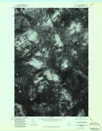
1976 Map of East Lake SE
USGS Topo · Published 1984About this map
The international border of Quebec Maine runs through this 1976 orthophotoquad, capturing a remote landscape of the Maine North Woods as it appeared in the mid-1970s. This aerial perspective, rectified by optical scanning, provides a literal look at the dense forest cover and drainage patterns that define the northern reaches of Aroostook County. The terrain is marked by a complex network of waterways, including the North Branch Twomile Brook and the South Branch Twomile Brook, which carve through the timberlands. The visible logging roads and clearings illustrate the active industrial forestry of the era, while the West Branch Five Mile Brook drains the southern portion of the sheet. Unlike standard topographic maps, this imagery records the actual vegetation and ground cover at the moment of the flight.
Find a feature on this map
4 named features on this map. Tap any name to fly to it.
Don’t see what you’re looking for? This feature index may not catch every label — zoom into the map to look around manually.
Map Details
Editions of this 1976 East Lake SE Map
2 editions found
Other maps of this area

1954 · Presque Isle
USGS Topo · 1:250,000

1955 · Rocky Mountain
USGS Topo · 1:62,500

1955 · Little East Lake
USGS Topo · 1:62,500

1955 · Round Pond
USGS Topo · 1:62,500

1955 · Seven Islands
USGS Topo · 1:62,500

1958 · Presque Isle
USGS Topo · 1:250,000

1960 · Presque Isle
USGS Topo · 1:250,000

1962 · Edmundston
USGS Topo · 1:250,000

1976 · East Lake
USGS Topo · 1:24,000

1976 · East Lake SE
USGS Topo · 1:24,000