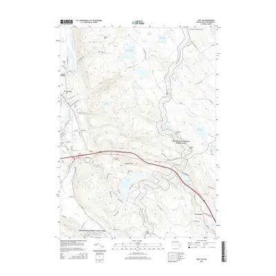
2015 Map of East Lee
USGS Topo · Published 2015About this map
The Housatonic River winds through the western valley of this Berkshire County landscape, anchoring the industrial and residential centers of Lee, Lenox Dale, and Lenox Station. To the east, the terrain rises sharply toward the heights of October Mtn and Bald Top, where the Appalachian National Scenic Trail traverses a series of high ridges and remote water bodies like Finerty Pond and Basin Pond. This 2015 data illustrates the coexistence of historic valley settlements and modern residential developments such as Leisure Lee, situated near the shores of Goose Pond. The presence of Mountain View Cem near Woods Pond and the small Blueberry Hill Airport (Private) provides specific landmarks for local history and genealogy research. The southeastern corner around West Becket shows the path of Jacobs Ladder Rd as it climbs through the hills, while numerous reservoirs and ponds like Buckley Dunton Lake suggest the region's long-standing reliance on its abundant water resources.
Find a feature on this map
106 named features on this map. Tap any name to fly to it.
Don’t see what you’re looking for? This feature index may not catch every label — zoom into the map to look around manually.
Map Details
Editions of this 2015 East Lee Map
This is the sole edition of this map. No revisions or reprints were ever made.
Other maps of this area

1885 · Sheffield
USGS Topo · 1:62,500

1886 · Becket
USGS Topo · 1:62,500

1888 · Sheffield
USGS Topo · 1:62,500

1888 · Becket
USGS Topo · 1:62,500

1888 · Sandisfield
USGS Topo · 1:62,500

1888 · Pittsfield
USGS Topo · 1:62,500

1890 · Pittsfield
USGS Topo · 1:62,500

1891 · Sheffield
USGS Topo · 1:62,500

1893 · Becket
USGS Topo · 1:62,500

1893 · Sheffield
USGS Topo · 1:62,500