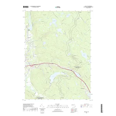
2018 Map of East Lee
USGS Topo · Published 2018About this map
The Housatonic River corridor defines the western edge of this Berkshire County landscape, where the Housatonic Railroad links the industrial and residential pockets of Lenox Station, Lenox Dale, and Lee. This 2018 survey reveals a territory shaped by both historic manufacturing and extensive protected lands, with the vast October Mtn forest occupying the northern heights. Moving eastward, the terrain climbs toward the high basins of Washington Mountain Lake and Goose Pond. The modern infrastructure of the Massachusetts Turnpike cuts through the center, yet the Appalachian National Scenic Trail maintains a winding, north-south passage through the high ridges, crossing near Greenwater Pond and Finerty Pond. Local history is anchored by sites like Mountain View Cem and the small crossroads of East Lee and West Becket.
Find a feature on this map
117 named features on this map. Tap any name to fly to it.
Don’t see what you’re looking for? This feature index may not catch every label — zoom into the map to look around manually.
Map Details
Editions of this 2018 East Lee Map
This is the sole edition of this map. No revisions or reprints were ever made.
Other maps of this area

1885 · Sheffield
USGS Topo · 1:62,500

1886 · Becket
USGS Topo · 1:62,500

1888 · Sheffield
USGS Topo · 1:62,500

1888 · Becket
USGS Topo · 1:62,500

1888 · Sandisfield
USGS Topo · 1:62,500

1888 · Pittsfield
USGS Topo · 1:62,500

1890 · Pittsfield
USGS Topo · 1:62,500

1891 · Sheffield
USGS Topo · 1:62,500

1893 · Becket
USGS Topo · 1:62,500

1893 · Sheffield
USGS Topo · 1:62,500