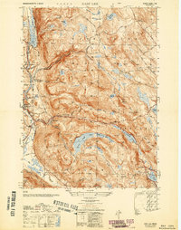
1950 Map of East Lee
USGS Topo · Published 1950About this map
The Housatonic River flows along the western edge of this Berkshire County landscape, serving as the industrial and transit corridor for Lee and Lenoxdale. The New York New Haven and Hartford railroad parallels the river, connecting these manufacturing centers to the broader regional economy. Rising sharply to the east, the rugged terrain of the October Mountain State Forest dominates the interior, a dense network of ridges and high-elevation water bodies including Felton Lake, Sandwash Reservoir, and Finerty Pond.
Find a feature on this map
53 named features on this map. Tap any name to fly to it.
Don’t see what you’re looking for? This feature index may not catch every label — zoom into the map to look around manually.
Map Details
Editions of this 1950 East Lee Map
This is the sole edition of this map. No revisions or reprints were ever made.
Other maps of this area

1885 · Sheffield
USGS Topo · 1:62,500

1886 · Becket
USGS Topo · 1:62,500

1888 · Sheffield
USGS Topo · 1:62,500

1888 · Becket
USGS Topo · 1:62,500

1888 · Sandisfield
USGS Topo · 1:62,500

1888 · Pittsfield
USGS Topo · 1:62,500

1890 · Pittsfield
USGS Topo · 1:62,500

1891 · Sheffield
USGS Topo · 1:62,500

1893 · Becket
USGS Topo · 1:62,500

1893 · Sheffield
USGS Topo · 1:62,500