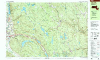
1997 Map of East Lee
USGS Topo · Published 1999About this map
October Mountain State Forest dominates this Berkshire County landscape, where the Appalachian Trail winds across high ridges like Washington Mtn and Becket Mtn. The 1990s terrain is characterized by a dense network of water bodies, including the expansive Goose Pond and the secluded Buckley Dunton Lake. In the lowlands, the Massachusetts Toll Road Turnpike cuts through the valley near East Lee, contrasting the modern high-speed corridor with the quiet, arts-focused legacy of the Jacob's Pillow School and Theatre. Small village centers like Becket Center and Bonny Rigg Corners maintain their traditional character, while the Conrail line follows the West Branch Westfield River through the narrow gap at Bancroft. This survey documents a region defined by public conservation lands and established summer camps like Camp Graylock and Camp Becket.
Find a feature on this map
93 named features on this map. Tap any name to fly to it.
Don’t see what you’re looking for? This feature index may not catch every label — zoom into the map to look around manually.
Map Details
Editions of this 1997 East Lee Map
This is the sole edition of this map. No revisions or reprints were ever made.
Other maps of this area

1885 · Sheffield
USGS Topo · 1:62,500

1886 · Chesterfield
USGS Topo · 1:62,500

1886 · Becket
USGS Topo · 1:62,500

1887 · Granville
USGS Topo · 1:62,500

1888 · Sheffield
USGS Topo · 1:62,500

1888 · Becket
USGS Topo · 1:62,500

1888 · Sandisfield
USGS Topo · 1:62,500

1888 · Chesterfield
USGS Topo · 1:62,500

1888 · Pittsfield
USGS Topo · 1:62,500

1889 · Granville
USGS Topo · 1:62,500