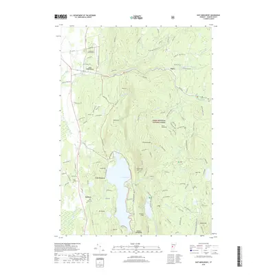
2018 Map of East Middlebury
USGS Topo · Published 2018About this map
Lake Dunmore and the rising peaks of the Green Mountain National Forest dominate the landscape in this part of Addison County. The terrain transitions sharply from the lowlands near Salisbury and East Middlebury to the heights of Mt Moosalamoo and Bryant Mtn. The hydrology of the area is defined by the Leicester River and the complex drainage of the Middlebury River, which is fed by several branches including the N Br Middlebury River. Cultural markers are scattered across the valley and foothills, from the Middlebury State Airport in the northwest to various family and community burial grounds such as Rice Cem and Nabby Cooper Cem. This survey illustrates the proximity of mountain wilderness to established valley settlements, connected by a network of local routes like Lake Dunmore Rd and School House Hill Rd. Notable landmarks like the Falls of Lana and Rattlesnake Point offer specific points of interest for those tracing the topography of the central Vermont region.
Find a feature on this map
117 named features on this map. Tap any name to fly to it.
Don’t see what you’re looking for? This feature index may not catch every label — zoom into the map to look around manually.
Map Details
Editions of this 2018 East Middlebury Map
This is the sole edition of this map. No revisions or reprints were ever made.
Other maps of this area

1902 · Brandon
USGS Topo · 1:62,500

1903 · Middlebury
USGS Topo · 1:62,500

1904 · Brandon
USGS Topo · 1:62,500

1905 · Middlebury
USGS Topo · 1:62,500

1915 · Rochester
USGS Topo · 1:62,500

1917 · Rochester
USGS Topo · 1:62,500

1919 · Lincoln Mountain
USGS Topo · 1:62,500

1920 · Lincoln Mountain
USGS Topo · 1:48,000

1920 · Brandon
USGS Topo · 1:62,500

1920 · Middlebury
USGS Topo · 1:62,500