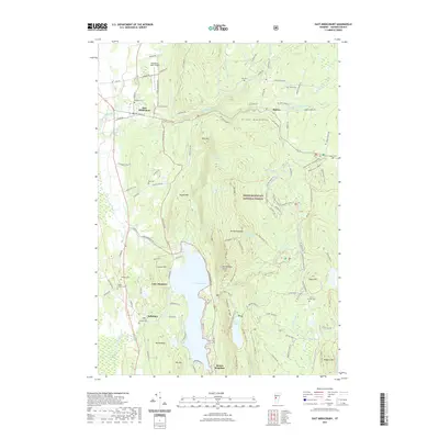
2021 Map of East Middlebury
USGS Topo · Published 2021About this map
Lake Dunmore dominates the western foothills of the Green Mountains, where the landscape transitions from the agricultural flats near Salisbury to the protected heights of the Green Mountain National Forest. This 2021 survey illustrates a region defined by recreational waters and rugged hiking corridors, including the Silver Lake Trl and Aunt Jenny Trl. Higher elevations are marked by distinctive peaks such as Mt Moosalamoo and Rattlesnake Point, while the northern reaches include the community of East Middlebury and the Middlebury State Airport. For genealogists, the map identifies several smaller burial grounds like Gee Cem and North Goshen Cem, often located near the winding courses of the Middlebury River and its various branches. The curious label of Satans Kingdom at the southern tip of the lake provides a glimpse into the colorful local toponymy of the Vermont wilderness.
Find a feature on this map
123 named features on this map. Tap any name to fly to it.
Don’t see what you’re looking for? This feature index may not catch every label — zoom into the map to look around manually.
Map Details
Editions of this 2021 East Middlebury Map
This is the sole edition of this map. No revisions or reprints were ever made.
Other maps of this area

1902 · Brandon
USGS Topo · 1:62,500

1903 · Middlebury
USGS Topo · 1:62,500

1904 · Brandon
USGS Topo · 1:62,500

1905 · Middlebury
USGS Topo · 1:62,500

1915 · Rochester
USGS Topo · 1:62,500

1917 · Rochester
USGS Topo · 1:62,500

1919 · Lincoln Mountain
USGS Topo · 1:62,500

1920 · Lincoln Mountain
USGS Topo · 1:48,000

1920 · Brandon
USGS Topo · 1:62,500

1920 · Middlebury
USGS Topo · 1:62,500