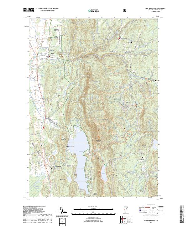
2024 Map of East Middlebury
USGS Topo · Published 2024About this map
East Middlebury sits at the foot of the Green Mountains, where the Middlebury River exits the steep terrain and enters the Champlain Valley. This modern survey illustrates the sharp transition from the settled lowlands to the protected expanse of the Green Mountain National Forest. While the eastern half is dominated by peaks like Mt Moosalamoo and Rattlesnake Point, the western corridor along the 7 Trl reveals a landscape dense with family-named burial grounds and historical markers. Small communities like Ripton and Salisbury are tied together by a network of historic routes including The Natural Tpke and School House Hill Rd. The map also details significant water features such as Lake Dunmore and Silver Lake, which have long served as central points for local recreation and industry in Addison County.
Find a feature on this map
128 named features on this map. Tap any name to fly to it.
Don’t see what you’re looking for? This feature index may not catch every label — zoom into the map to look around manually.
Map Details
Editions of this 2024 East Middlebury Map
This is the sole edition of this map. No revisions or reprints were ever made.
Other maps of this area

1902 · Brandon
USGS Topo · 1:62,500

1903 · Middlebury
USGS Topo · 1:62,500

1904 · Brandon
USGS Topo · 1:62,500

1905 · Middlebury
USGS Topo · 1:62,500

1915 · Rochester
USGS Topo · 1:62,500

1917 · Rochester
USGS Topo · 1:62,500

1919 · Lincoln Mountain
USGS Topo · 1:62,500

1920 · Lincoln Mountain
USGS Topo · 1:48,000

1920 · Brandon
USGS Topo · 1:62,500

1920 · Middlebury
USGS Topo · 1:62,500