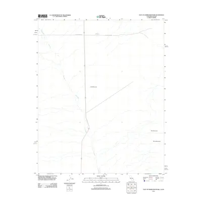
2012 Map of East of Homer Mountain
USGS Topo · Published 2012About this map
The Old Government Rd and the Mojave Trl cross the northern reaches of this high-desert landscape, tracing historic pathways of migration and commerce across San Bernardino County. These routes navigate the arid terrain between the Piute Mountains to the west and the Dead Mountains to the east. The dominance of these historical thoroughfares highlights the enduring importance of this corridor for travel between California and Nevada. Most of the topography is defined by the drainage patterns of Piute Wash, which trends southward toward the prominence of Mount Manchester. The map captures a transition point where ancient trails intersect with modern highway infrastructure, preserving the spatial relationship of landmarks used by desert travelers for generations.
Find a feature on this map
6 named features on this map. Tap any name to fly to it.
Don’t see what you’re looking for? This feature index may not catch every label — zoom into the map to look around manually.
Map Details
Editions of this 2012 East of Homer Mountain Map
This is the sole edition of this map. No revisions or reprints were ever made.
Other maps of this area

1886 · Camp Mohave
USGS Topo · 1:250,000

1892 · Camp Mohave
USGS Topo · 1:250,000

1903 · Needles
USGS Topo · 1:125,000

1904 · Needles Special
USGS Topo · 1:125,000

1926 · Mohave City
USGS Topo · 1:96,000

1942 · Camp Mohave
USGS Topo · 1:250,000

1943 · Bannock
USGS Topo · 1:62,500

1947 · Kingman
USGS Topo · 1:250,000

1948 · Kingman
USGS Topo · 1:250,000

1950 · Davis Dam
USGS Topo · 1:62,500