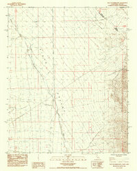
1984 Map of East of Homer Mtn
USGS Topo · Published 1984About this map
Piute Valley dominates this high-desert landscape at the intersection of the California and Nevada border. The 1984 survey highlights the historical Von Schmidt Line (1873), an early state boundary survey that cuts across the northern desert floor. To the east, the rugged Dead Mountains rise sharply, while the ephemeral Piute Wash threads through the valley bottom. Transportation and infrastructure are represented by the Old Government Road and a modern Steel Tower Transmission Line. Evidence of early mineral exploration is visible in the foothills of the range, noted by several Prospect Shafts and a single Shaft, indicating the localized prospecting common in this arid region during the late nineteenth and early twentieth centuries.
Find a feature on this map
10 named features on this map. Tap any name to fly to it.
Don’t see what you’re looking for? This feature index may not catch every label — zoom into the map to look around manually.
Map Details
Editions of this 1984 East of Homer Mtn Map
This is the sole edition of this map. No revisions or reprints were ever made.
Other maps of this area

1886 · Camp Mohave
USGS Topo · 1:250,000

1892 · Camp Mohave
USGS Topo · 1:250,000

1903 · Needles
USGS Topo · 1:125,000

1904 · Needles Special
USGS Topo · 1:125,000

1926 · Mohave City
USGS Topo · 1:96,000

1942 · Camp Mohave
USGS Topo · 1:250,000

1943 · Bannock
USGS Topo · 1:62,500

1947 · Kingman
USGS Topo · 1:250,000

1948 · Kingman
USGS Topo · 1:250,000

1950 · Davis Dam
USGS Topo · 1:62,500