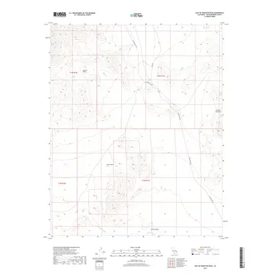
2018 Map of East of Kingston Peak
USGS Topo · Published 2018About this map
The Kingston Range dominates the northern reaches of this map, marking a transition point between the higher elevations and the broader expanse of the Mojave Desert to the south. Transportation through this arid landscape is defined by the prominent Excelsior Mine Rd, which traverses the terrain from the northwest towards the southern boundaries of the quadrangle. This road reflects the region's enduring connection to mineral extraction and desert access routes.
Find a feature on this map
12 named features on this map. Tap any name to fly to it.
Don’t see what you’re looking for? This feature index may not catch every label — zoom into the map to look around manually.
Map Details
Editions of this 2018 East of Kingston Peak Map
This is the sole edition of this map. No revisions or reprints were ever made.
Other maps of this area

1910 · Ivanpah
USGS Topo · 1:250,000

1912 · Ivanpah
USGS Topo · 1:250,000

1942 · Ivanpah
USGS Topo · 1:250,000

1947 · Kingman
USGS Topo · 1:250,000

1948 · Kingman
USGS Topo · 1:250,000

1954 · Kingman
USGS Topo · 1:250,000

1955 · Kingman
USGS Topo · 1:250,000
1955 · Kingston Peak
USGS Topo · 1:62,500
1956 · Clark Mountain
USGS Topo · 1:62,500
1956 · Shenandoah Peak
USGS Topo · 1:62,500