
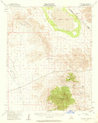
1956 Map of Clark Mountain
USGS Topo · Published 1957About this map
High-altitude desert peaks and industrial mining sites dominate this mid-century survey of the California-Nevada border. The Clark Mountain Range rises sharply in the southeast, housing a cluster of historic mineral operations including the Colosseum Mine, Antimony Mine, and Copper World Mine. These remote sites are linked by rugged passages like Keany Pass and the distinctive Old Traction Road, which once served as a vital freight corridor for ore.
Find a feature on this map
30 named features on this map. Tap any name to fly to it.
Don’t see what you’re looking for? This feature index may not catch every label — zoom into the map to look around manually.
Map Details
Editions of this 1956 Clark Mountain Map
3 editions found
Other maps of this area

1910 · Ivanpah
USGS Topo · 1:250,000

1912 · Ivanpah
USGS Topo · 1:250,000

1942 · Ivanpah
USGS Topo · 1:250,000

1947 · Kingman
USGS Topo · 1:250,000

1948 · Kingman
USGS Topo · 1:250,000

1954 · Kingman
USGS Topo · 1:250,000

1955 · Kingman
USGS Topo · 1:250,000

1955 · Kingston Peak
USGS Topo · 1:62,500

1955 · Mescal Range
USGS Topo · 1:62,500

1955 · Roach Lake
USGS Topo · 1:62,500