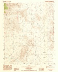
1984 Map of East of Kingston Peak
USGS Topo · Published 1985About this map
Kingston Range and Mesquite Mountains define the high relief of this California desert landscape, where the Mojave's characteristic alluvial fans spill into the broad expanse of Shadow Valley. This 1984 provisional survey documents a region defined by mineral exploration and arid-land management, evidenced by the scattered Prospects and the presence of a Guzzler for desert wildlife. Human activity is largely confined to the primitive network of tracks, most notably the Excelsior Mine Road, which cuts diagonally across the valley floor. The map provides a precise look at the drainage patterns of Kingston Wash before they disappear into the valley basin, offering a technical view of the San Bernardino County backcountry during the late twentieth century.
Find a feature on this map
9 named features on this map. Tap any name to fly to it.
Don’t see what you’re looking for? This feature index may not catch every label — zoom into the map to look around manually.
Map Details
Editions of this 1984 East of Kingston Peak Map
This is the sole edition of this map. No revisions or reprints were ever made.
Other maps of this area

1910 · Ivanpah
USGS Topo · 1:250,000

1912 · Ivanpah
USGS Topo · 1:250,000

1942 · Ivanpah
USGS Topo · 1:250,000

1947 · Kingman
USGS Topo · 1:250,000

1948 · Kingman
USGS Topo · 1:250,000

1954 · Kingman
USGS Topo · 1:250,000

1955 · Kingman
USGS Topo · 1:250,000

1955 · Kingston Peak
USGS Topo · 1:62,500

1956 · Clark Mountain
USGS Topo · 1:62,500

1956 · Shenandoah Peak
USGS Topo · 1:62,500