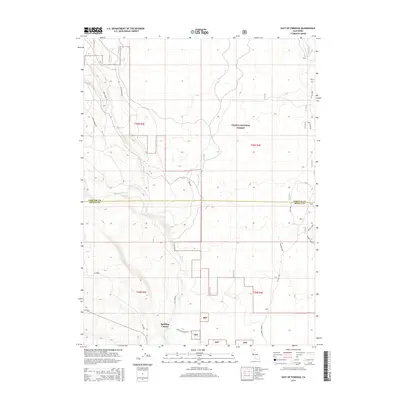
2015 Map of East of Pondosa
USGS Topo · Published 2015About this map
Spalding Corner serves as the primary landmark in this section of Northern California, where the boundaries of Siskiyou and Shasta counties meet. The landscape is characterized by its volcanic geography, evidenced by features such as W Lava Rim Rd and Crater Road. Much of the territory is protected within the Shasta National Forest, showing a network of specialized routes like Long Grade Rd and Short Grade Rd that navigate the varied elevations. Industrial infrastructure is also present, marked by the Pit Gas Pipe and several other utility corridors. Bear Cr provides a natural drainage through the center of the sheet, while family-named roads like Ted Elder Rd and McNab Rd hint at the local landholders and historical access points that defined the area's rural development in the early 21st century.
Find a feature on this map
21 named features on this map. Tap any name to fly to it.
Don’t see what you’re looking for? This feature index may not catch every label — zoom into the map to look around manually.
Map Details
Editions of this 2015 East of Pondosa Map
This is the sole edition of this map. No revisions or reprints were ever made.
Other maps of this area

1886 · Modoc Lava Bed
USGS Topo · 1:250,000

1892 · Modoc Lava-Bed
USGS Topo · 1:250,000

1932 · Bartle
USGS Topo · 1:96,000

1939 · Bartle
USGS Topo · 1:125,000

1954 · Alturas
USGS Topo · 1:250,000

1958 · Alturas
USGS Topo · 1:250,000

1961 · Hambone
USGS Topo · 1:62,500

1961 · Pondosa
USGS Topo · 1:62,500

1961 · Fall River Mills
USGS Topo · 1:62,500

1962 · Alturas
USGS Topo · 1:250,000