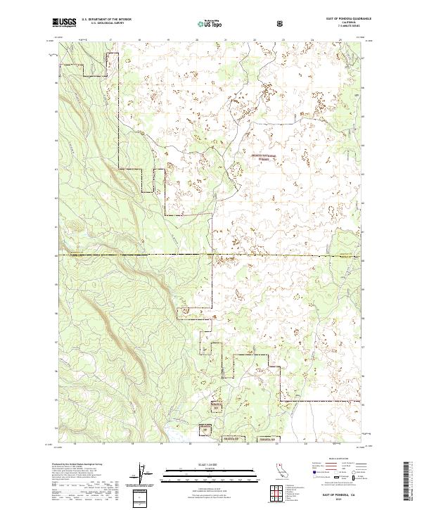
2021 Map of East of Pondosa
USGS Topo · Published 2021About this map
Shasta National Forest dominates this landscape along the border of Siskiyou and Shasta counties, where the high volcanic terrain of Northern California is etched by drainages and utility corridors. The map reveals a complex network of forest routes, including Long Grade Rd and W Lava Rim Rd, which navigate the elevation changes characteristic of the Modoc Plateau region. Water is scarce in this upland environment, with Bear Cr serving as a primary drainage feature. This 2021 survey also documents industrial infrastructure, such as the Pit Gas Pipe line cutting across the eastern sections of the quadrangle. Historians and researchers can trace older transportation routes like Old Co Rd and Mcarthur Rd, which provide context for the logging and ranching operations that have long shaped this part of the Shasta NF.
Find a feature on this map
18 named features on this map. Tap any name to fly to it.
Don’t see what you’re looking for? This feature index may not catch every label — zoom into the map to look around manually.
Map Details
Editions of this 2021 East of Pondosa Map
This is the sole edition of this map. No revisions or reprints were ever made.
Other maps of this area

1886 · Modoc Lava Bed
USGS Topo · 1:250,000

1892 · Modoc Lava-Bed
USGS Topo · 1:250,000

1932 · Bartle
USGS Topo · 1:96,000

1939 · Bartle
USGS Topo · 1:125,000

1954 · Alturas
USGS Topo · 1:250,000

1958 · Alturas
USGS Topo · 1:250,000

1961 · Hambone
USGS Topo · 1:62,500

1961 · Pondosa
USGS Topo · 1:62,500

1961 · Fall River Mills
USGS Topo · 1:62,500

1962 · Alturas
USGS Topo · 1:250,000