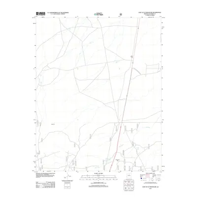
2011 Map of East of S P Mountain
USGS Topo · Published 2011About this map
Hanks Trading Post serves as a lone commercial outpost along the highway in this high-desert landscape of Coconino County. The northeastern portion of the map is defined by the boundary of Wupatki National Monument, where the terrain transitions toward the vast open stretches of Deadman Flat. A network of unpaved forest service roads and tracks, such as the Tuba City Road, crisscross the area, reflecting the seasonal movement and ranching history of the region.
Find a feature on this map
42 named features on this map. Tap any name to fly to it.
Don’t see what you’re looking for? This feature index may not catch every label — zoom into the map to look around manually.
Map Details
Editions of this 2011 East of S P Mountain Map
This is the sole edition of this map. No revisions or reprints were ever made.
Other maps of this area

1886 · San Francisco Mtns
USGS Topo · 1:250,000
1891 · San Francisco Mtns
USGS Topo · 1:250,000

1894 · San Francisco Mtns
USGS Topo · 1:250,000
1899 · San Francisco Mtns
USGS Topo · 1:250,000

1908 · Flagstaff
USGS Topo · 1:125,000

1912 · Flagstaff
USGS Topo · 1:125,000

1947 · Flagstaff
USGS Topo · 1:250,000

1954 · Flagstaff
USGS Topo · 1:250,000

1958 · Flagstaff
USGS Topo · 1:250,000
1960 · Flagstaff
USGS Topo · 1:250,000