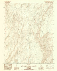
1987 Map of East of Waucoba Canyon
USGS Topo · Published 1987About this map
Saline Range peaks dominate this high-desert landscape, where steep topography transitions into the northern reaches of the Saline Valley. This 1987 edition, based on photography from the early 1980s, reveals a stark wilderness defined by dramatic elevation changes rather than human settlement. In this arid environment, water is a critical and rare element, marked notably by several Falls that suggest seasonal runoff or spring-fed drainages cutting through the rocky canyons. The northwestern corner is defined by the Waucoba Wash, a primary drainage feature that orients the surrounding complex terrain. Aside from a few unimproved trails and the boundary line between townships T 11 S and T 12 S, the area remains remarkably undeveloped, serving as a clear record of the geological character of this Inyo County interior.
Find a feature on this map
63 named features on this map. Tap any name to fly to it.
Don’t see what you’re looking for? This feature index may not catch every label — zoom into the map to look around manually.
Map Details
Editions of this 1987 East of Waucoba Canyon Map
This is the sole edition of this map. No revisions or reprints were ever made.
Other maps of this area

1908 · Lida
USGS Topo · 1:250,000

1908 · Ballarat
USGS Topo · 1:250,000

1913 · Lida
USGS Topo · 1:250,000

1913 · Ballarat
USGS Topo · 1:250,000

1948 · Death Valley
USGS Topo · 1:250,000

1951 · Waucoba Wash
USGS Topo · 1:62,500

1954 · Death Valley
USGS Topo · 1:250,000

1954 · Goldfield
USGS Topo · 1:250,000

1955 · Goldfield
USGS Topo · 1:250,000

1956 · Death Valley
USGS Topo · 1:250,000