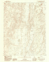
1987 Map of East of Waucoba Spring
USGS Topo · Published 1987About this map
Saline Range dominates this 1980s terrain study, revealing the stark geological character of Inyo County. The high-altitude landscape is defined by its arid basins and significant elevation shifts, most notably evidenced by multiple instances of Dry Lake scattered throughout the depressions of the range. To the northeast, the terrain descends toward the Eureka Valley, where shifting Sand Dunes are specifically noted along the valley floor. The map also traces the winding path of Marble Canyon in the northwest, providing a detailed record of the drainage patterns and landforms as they existed during the 1984 field check. This provisional edition preserves the precise topographic data of a sparsely settled region where environmental features dictate the layout of the land.
Find a feature on this map
5 named features on this map. Tap any name to fly to it.
Don’t see what you’re looking for? This feature index may not catch every label — zoom into the map to look around manually.
Map Details
Editions of this 1987 East of Waucoba Spring Map
This is the sole edition of this map. No revisions or reprints were ever made.
Other maps of this area

1908 · Lida
USGS Topo · 1:250,000

1908 · Ballarat
USGS Topo · 1:250,000

1913 · Lida
USGS Topo · 1:250,000

1913 · Ballarat
USGS Topo · 1:250,000

1948 · Death Valley
USGS Topo · 1:250,000

1951 · Waucoba Wash
USGS Topo · 1:62,500

1954 · Death Valley
USGS Topo · 1:250,000

1954 · Goldfield
USGS Topo · 1:250,000

1955 · Goldfield
USGS Topo · 1:250,000

1956 · Death Valley
USGS Topo · 1:250,000