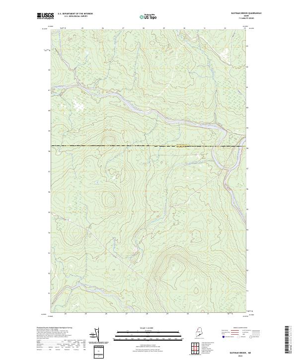
2024 Map of Eastman Brook
USGS Topo · Published 2024About this map
The confluence of major river branches defines this wooded borderlands region where the Northwest Branch Saint John River and Southwest Branch Saint John River shape the hydrology of the upper Saint John Valley. This 2024 landscape is characterized by its network of watercourses, including the Daaquam River and the namesake Eastman Brook, which flow through the timberlands near the Aroostook and Somerset county line. The map reveals the modern infrastructure of a working forest, where functional routes like Realty Rd, Depot Rd, and St Juste Rd provide the primary access to these remote northern reaches. The drainage patterns of Bean Brook and Oak Brook illustrate the intricate wetland and tributary systems that feed the primary Saint John River corridor, reflecting the area's ongoing identity as a critical watershed and resource zone.
Find a feature on this map
11 named features on this map. Tap any name to fly to it.
Don’t see what you’re looking for? This feature index may not catch every label — zoom into the map to look around manually.
Map Details
Editions of this 2024 Eastman Brook Map
This is the sole edition of this map. No revisions or reprints were ever made.
Other maps of this area

1954 · Baker Lake
USGS Topo · 1:62,500

1954 · Presque Isle
USGS Topo · 1:250,000

1955 · Beaver Pond
USGS Topo · 1:62,500

1957 · Hardwood Mountain
USGS Topo · 1:62,500

1958 · Presque Isle
USGS Topo · 1:250,000

1960 · Presque Isle
USGS Topo · 1:250,000

1962 · Baker Lake
USGS Topo · 1:62,500

1962 · Quebec
USGS Topo · 1:250,000
1977 · Burntland Pond
USGS Topo · 1:24,000
1986 · Mary L Pond
USGS Topo · 1:24,000