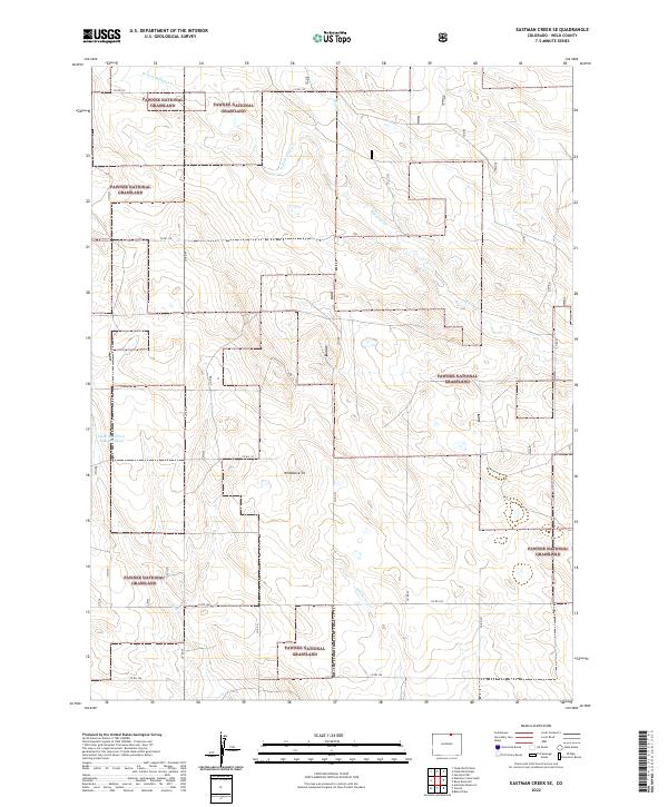
2022 Map of Eastman Creek SE
USGS Topo · Published 2022About this map
The Pawnee National Grassland dominates this portion of the northern Colorado high plains, where the land is defined by a sparse network of ephemeral drainages and section-line roads. The landscape is marked by subtle topographic rises, most notably the peak known as Wildhorse Tit, which overlooks a series of seasonal watercourses including Wildhorse Cr and Coal Cr. This map documents a region where the vast open range of the national grassland is interspersed with private holdings, illustrating the enduring township and range surveying system established by the General Land Office.
Find a feature on this map
25 named features on this map. Tap any name to fly to it.
Don’t see what you’re looking for? This feature index may not catch every label — zoom into the map to look around manually.
Map Details
Editions of this 2022 Eastman Creek SE Map
This is the sole edition of this map. No revisions or reprints were ever made.
Other maps of this area

1908 · Eaton
USGS Topo · 1:125,000

1910 · Eaton
USGS Topo · 1:125,000

1954 · Greeley
USGS Topo · 1:250,000

1957 · Greeley
USGS Topo · 1:250,000

1958 · Greeley
USGS Topo · 1:250,000

1960 · Purcell
USGS Topo · 1:24,000
1960 · Antelope Reservoir
USGS Topo · 1:24,000

1961 · Greeley
USGS Topo · 1:250,000

1964 · Greeley
USGS Topo · 1:250,000

1965 · Greeley
USGS Topo · 1:250,000