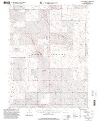
1997 Map of Eastman Creek SE
USGS Topo · Published 2000About this map
Pawnee National Grassland dominates this landscape in northern Colorado, where the high plains terrain is defined by a sparse network of essential water infrastructure. The map records a series of drainage systems including West Fork Willow Creek, Willow Creek, and Wildhorse Creek, alongside the curiously named Wildhorse Tit landmark. A legacy of ranching and early land management is evident in the dense distribution of windmills and water tanks, many bearing local family names like the McNamara Jr Windmill, Lamm Windmill, and Erickson Windmill Water Tank. Within the grassland borders, specialized features such as a Wildlife Enclosure and the Jackpot Well indicate the dual uses of this territory for conservation and resource extraction. The presence of numerous named windmills like the Fourteen Windmill and Vivian Windmill suggests a reliance on groundwater to sustain livestock across these open Weld County reaches.
Find a feature on this map
23 named features on this map. Tap any name to fly to it.
Don’t see what you’re looking for? This feature index may not catch every label — zoom into the map to look around manually.
Map Details
Editions of this 1997 Eastman Creek SE Map
This is the sole edition of this map. No revisions or reprints were ever made.
Other maps of this area

1908 · Eaton
USGS Topo · 1:125,000

1910 · Eaton
USGS Topo · 1:125,000

1954 · Greeley
USGS Topo · 1:250,000

1957 · Greeley
USGS Topo · 1:250,000

1958 · Greeley
USGS Topo · 1:250,000

1960 · Purcell
USGS Topo · 1:24,000
1960 · Antelope Reservoir
USGS Topo · 1:24,000

1961 · Greeley
USGS Topo · 1:250,000

1964 · Greeley
USGS Topo · 1:250,000

1965 · Greeley
USGS Topo · 1:250,000