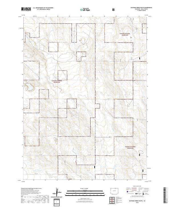
2022 Map of Eastman Creek South
USGS Topo · Published 2022About this map
Pawnee National Grassland dominates the landscape of this Weld County region, characterized by its network of seasonal drainage creeks and a strictly gridded system of rural roads. The terrain is defined by the winding paths of Eastman Cr, Owl Creek, and Robinson Cr, which carve subtle topography through the high plains. In the southern reach of the survey, Little Owl Cr and Owl Cr converge near the intersection of Co Rd 106 and Co Rd 37. This map documents a contemporary view of a traditional agricultural and conservation landscape where the Public Land Survey System lines dictate the placement of local routes like Co Rd 114 and Co Rd 122. The absence of dense settlements emphasizes the preservation of the grassland and the continuity of the open range in eastern Colorado.
Find a feature on this map
22 named features on this map. Tap any name to fly to it.
Don’t see what you’re looking for? This feature index may not catch every label — zoom into the map to look around manually.
Map Details
Editions of this 2022 Eastman Creek South Map
This is the sole edition of this map. No revisions or reprints were ever made.
Other maps of this area

1908 · Eaton
USGS Topo · 1:125,000

1910 · Eaton
USGS Topo · 1:125,000

1954 · Greeley
USGS Topo · 1:250,000

1957 · Greeley
USGS Topo · 1:250,000

1958 · Greeley
USGS Topo · 1:250,000

1960 · Purcell
USGS Topo · 1:24,000
1960 · Nunn
USGS Topo · 1:24,000
1960 · Antelope Reservoir
USGS Topo · 1:24,000

1961 · Greeley
USGS Topo · 1:250,000

1964 · Greeley
USGS Topo · 1:250,000