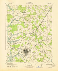
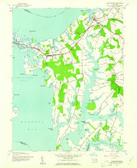
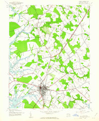
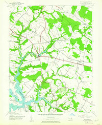
1943 Map of Easton
USGS Topo · Published 1943About this map
The Tidewater landscape of Talbot County centers on the thriving hub of Easton, where the regional rail network and maritime trade converge. During the early 1940s, the Baltimore and Eastern and the Pennsylvania (Oxford Branch) railroads intersected in town, facilitating the transport of goods from local waters like the Tred Avon River and Miles River. The map documents a period of infrastructure expansion, notably labeling the Easton Maryland Airport as being under construction. Surrounding the urban center, the landscape is defined by established estates and historic rural identifiers such as The Anchorage, Magee Chapel, and All Saints Church. From the residential developments at St Aubins Heights to the scattered hamlets of Longwoods and Woodland, this survey provides a look at the county seat during a era of wartime growth and modernization.
Find a feature on this map
38 named features on this map. Tap any name to fly to it.
Don’t see what you’re looking for? This feature index may not catch every label — zoom into the map to look around manually.
Map Details
Editions of this 1943 Easton Map
This is the sole edition of this map. No revisions or reprints were ever made.
Other maps of this area

1898 · Choptank
USGS Topo · 1:125,000

1904 · St. Michaels
USGS Topo · 1:62,500

1904 · Oxford
USGS Topo · 1:62,500

1905 · Denton
USGS Topo · 1:62,500

1905 · Hurlock
USGS Topo · 1:62,500

1908 · Choptank
USGS Topo · 1:125,000

1942 · Oxford
USGS Topo · 1:31,680
1942 · Queenstown
USGS Topo · 1:24,000
1942 · Easton
USGS Topo · 1:24,000
1942 · Wye Mills
USGS Topo · 1:24,000