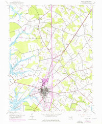
1942 Map of Easton
USGS Topo · Published 1976About this map
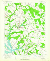
Easton serves as the focal point of this Maryland Eastern Shore landscape, situated where the Tred Avon River and the Miles River systems reach inland. The 1942 topography, updated with mid-1970s land use changes, reveals a community built upon a complex network of creeks like Goldsborough Creek and Glebe Creek. The map documents the shifting transportation infrastructure of Talbot County, featuring the Pennsylvania Central railroad and an old railroad grade, alongside the developing Easton Municipal Airport. Genealogists and local historians can locate established landmarks such as All Saints Ch, Spring Hill Cem, and Magee Chapel. The surrounding countryside is dotted with historic property names like The Anchorage and Bloomfield, while the waterfront near Easton Point illustrates the deep connection between the town and its navigable tidal waters.
Find a feature on this map
35 named features on this map. Tap any name to fly to it.
Don’t see what you’re looking for? This feature index may not catch every label — zoom into the map to look around manually.
Map Details
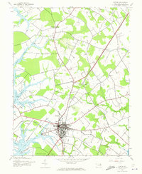
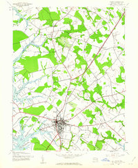
Editions of this 1942 Easton Map
3 editions found
Other maps of this area

1898 · Choptank
USGS Topo · 1:125,000

1904 · St. Michaels
USGS Topo · 1:62,500

1904 · Oxford
USGS Topo · 1:62,500

1905 · Denton
USGS Topo · 1:62,500

1905 · Hurlock
USGS Topo · 1:62,500

1908 · Choptank
USGS Topo · 1:125,000

1942 · Oxford
USGS Topo · 1:31,680
1942 · Queenstown
USGS Topo · 1:24,000
1942 · Easton
USGS Topo · 1:24,000
1942 · Wye Mills
USGS Topo · 1:24,000