Old Maps of Talbot County, Maryland
Explore 149 old maps of Talbot County, spanning from 1892 to today. These high-resolution historic maps reveal how streets, neighborhoods, landmarks, and natural features evolved over time — perfect for genealogy, metal detecting, research, and local history exploration.
What you can do with these maps:
- See how Talbot County changed over time: Compare historical maps to modern-day views to trace roads, homesites, rail lines & more.
- View detailed metadata: Each map includes creators, publishers, year, scale, and archive source.
- Overlay maps with satellite & LiDAR: Visualize the past alongside modern tools to explore terrain & human change.
- Trusted historical sources: Maps sourced from the USGS, Library of Congress, and other archives.
- Access maps your way: View online, download high-res files, or order prints for personal or research use.
Start exploring old maps of Talbot County to uncover forgotten places, hidden landmarks, and the deep history beneath your feet.
Talbot County, MD maps
(149)- 1892 Map of Annapolis
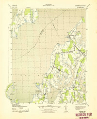
 1892 Annapolis1892 Print · USGSMaryland's capital and the surrounding Chesapeake Bay shores appear here during the late Victorian era, before modern bridges linked the coastlines. Genealogists can trace early homesteads and rail lines in Annapolis or explore eastern shore landings like Claiborne and Kent Island.2 unique versions available
 - 1893 Map of Sharps Island
 1893 Sharps Island1893 Print · USGSThe Eastern Shore of Maryland is seen here in the 1890s, when Sharps Island and its lighthouse still commanded the mouth of the Choptank. Researchers can trace historic shorelines and early settlements like Tilghman and Neavitt before significant coastal erosion changed the bay.3 unique versions available
 - 1898 Map of Choptank
 1898 Choptank1898 Print · USGSThe Maryland Eastern Shore and its intricate Chesapeake coastline are documented here in the late 1890s. Genealogists can trace family roots in Annapolis or Easton, while maritime historians can locate historic landings such as Corners Wharf and Wye Landing.2 unique versions available
 - 1904 Map of St. Michaels
 1904 St. Michaels1904 Print · USGSThe Eastern Shore’s tidewater landscape at the start of the twentieth century is defined by its deep estuaries and thriving river towns. Genealogists and historians can trace the old rail lines of the Baltimore and Eastern Shore RR and locate historic landings like Probasco Landing and Skipton Landing.3 unique versions available
 - 1904 Map of Annapolis
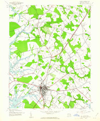
 1904 Annapolis1904 Print · USGSMaryland's capital and the Eastern Shore are captured in detail just after the turn of the century. Genealogists and maritime historians can trace property near Annapolis, the grounds of the U. S. Naval Academy, and remote settlements like Stevensville on Kent Island.5 unique versions available
 - 1904 Map of Sharps Island
 1904 Sharps Island1904 Print · USGSThe Eastern Shore at the turn of the century shows a world of tidewater landings and island communities along the Choptank River. Genealogists and maritime historians can trace early settlements like Neavitt and Avalon, or locate the original site of the Sharps Island L.H.3 unique versions available
 - 1904 Map of Oxford
 1904 Oxford1904 Print · USGSCoastal Maryland at the start of the twentieth century was a world of steamships, rail landings, and tide-driven commerce. Genealogists can trace early homesteads and watermen's hubs near Cambridge, Oxford, and the landing at Trappe Ldg.3 unique versions available
 - 1905 Map of Denton
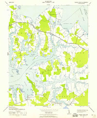
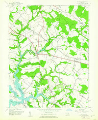
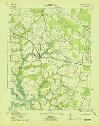
 1905 Denton1905 Print · USGSMaryland's Eastern Shore appears at the height of its riverboat and rail era, centered on the Choptank River. Genealogists and historians can trace the Steamboat Route to Wayman Wharf or locate old community hubs like American Corners and the Laurel Grove Church.3 unique versions available
 - 1905 Map of Hurlock
 1905 Hurlock1905 Print · USGSDorchester and Caroline Counties thrive on a river-and-rail economy at the turn of the century. Genealogists can trace family roots through landings and crossings like Tennalls Wharf, Harrison Ferry, and the junction at Hurlock.3 unique versions available
 - 1908 Map of Choptank
 1908 Choptank1908 Print · USGSMaryland's Eastern Shore and the Chesapeake Bay are captured here at the start of the twentieth century, showing a world of steamships and rail. Genealogists can trace family names at St Michaels, Oxford, and waterfront landings like Claiborne or Arundel on the Bay.5 unique versions available
 - 1942 Map of Tilghman
 1942 Tilghman1942 Print · USGSChesapeake maritime life is captured here during the early war years, focusing on the communities of the Talbot County peninsula. Genealogists can trace family footprints through the Tilghman and Fairbank settlements, Peoples Chapel, and the Tilghman Island Landing.3 unique versions available
 - 1942 Map of Oxford
 1942 Oxford1942 Print · USGSThe Tred Avon and Choptank rivers dominate this coastal Maryland landscape during the early 1940s. Genealogists can trace family roots through the St Paul Church, John Wesley Church, and the Choptank River Lighthouse that guided local mariners.3 unique versions available
 - 1942 Map of Church Creek, 1958 Print
 1942 Church Creek1958 Print · USGSThe Dorchester County tidewater region during the early 1940s is shown here through its intricate shoreline and rural peninsula settlements. Genealogists and historians can trace family roots through landmarks like Mace Cemetery, Gethsemane Church, and the village of Madison.2 unique versions available
 - 1942 Map of Claiborne, 1961 Print
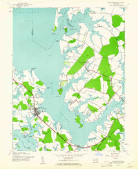
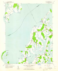 1942 Claiborne1961 Print · USGSCoastal Talbot County is captured here in the early 1940s, featuring the busy rail-to-ferry connection at Claiborne. Genealogists and historians can trace family locations near McDaniel and Bozman, or locate local landmarks like St Johns Ch and Wittman Sch.4 unique versions available
 - 1942 Map of Kent Island, 1961 Print
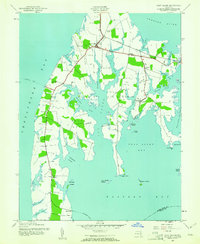 1942 Kent Island1961 Print · USGSKent Island at the onset of the 1940s remained a landscape of ferry landings and rail terminals along the Chesapeake. Genealogists and local historians can trace family locations near Batts Neck Sch, Stevensville, and the Baltimore and Eastern RR line.3 unique versions available
 - 1942 Map of Queenstown, 1961 Print
 1942 Queenstown1961 Print · USGSMaryland's Eastern Shore at the start of the 1940s reveals a landscape shaped by tidal creeks and the rail-and-water economy. Genealogists can trace family footprints near St Peters Ch, Grasonville Cem, and the historic waterfront of Queenstown.3 unique versions available
 - 1942 Map of Easton, 1961 Print
 1942 Easton1961 Print · USGSMaryland's Eastern Shore center at Easton is captured here during the early war years, showing a town integrated with its rail and river networks. Local historians can trace family locations at St Aubins Heights, Spring Hill Cem, and the historic waterfront at Easton Point.3 unique versions available
 - 1942 Map of Wye Mills, 1961 Print
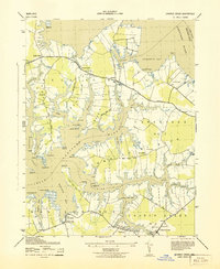
 1942 Wye Mills1961 Print · USGSThe Eastern Shore comes alive in the 1940s as the Baltimore and Eastern railroad threads through a landscape of tidal creeks and colonial-era parishes. Genealogists can trace family footprints at Old Wye Ch, the crossroads of Skipton, and the small fishing outpost at Wye Landing.2 unique versions available
 - 1942 Map of Sharps Island, 1961 Print
 1942 Sharps Island1961 Print · USGSThe Dorchester County coast and its isolated island landmasses are detailed in this wartime survey of the Chesapeake. Genealogists and historians can trace old homesteads around Thomas, the Hudson Sch, and the shifting shorelines of James Island.
 - 1942 Map of St. Michaels, 1961 Print
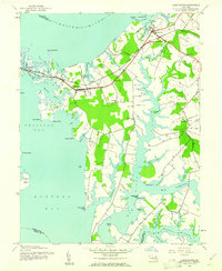
 1942 St. Michaels1961 Print · USGSMid-century Talbot County is defined by its winding Chesapeake tributaries and the established harbor at St Michaels. Genealogists and historians can trace the rail-and-water corridors of the Baltimore and Eastern through settlements like Tunis Mills and Newcomb.3 unique versions available
 - 1942 Map of Trappe, 1962 Print
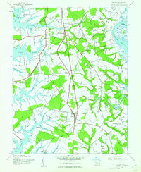 1942 Trappe1962 Print · USGSMaryland's Eastern Shore appears here in the early 1940s, showing a landscape defined by tidal necks and the Pennsylvania railroad. Genealogists and local historians can trace small settlements like Stumptown, rural sites such as Union Ch, and several family burial grounds including Merrick Cem.3 unique versions available
 - 1943 Map of Claiborne
 1943 Claiborne1943 Print · USGSTalbot County’s waterfront communities are captured in the early 1940s, showing a landscape shaped by the Chesapeake Bay and local rail lines. Genealogists and historians can trace the foundations of Claiborne and Sherwood, or locate landmarks like Wesley Church and the McDaniel RR Sta.
 - 1943 Map of Sharps Island
 1943 Sharps Island1943 Print · USGSCoastal Dorchester County is captured during the early 1940s, showing a landscape of neck lands and island settlements. Genealogists and local historians can trace family locations near Hubbards Church, the Hudson School, and the remote James Island.
 - 1943 Map of Wye Mills
 1943 Wye Mills1943 Print · USGSMaryland's Eastern Shore during the mid-1940s reveals a landscape of tidal creeks and quiet parish life. Genealogists and historians can locate Old Wye Church, the rural Newton School, and the Wye Mills RR Sta along the Baltimore and Eastern line.
 - 1943 Map of Church Creek
 1943 Church Creek1943 Print · USGSDorchester County's intricate tidal landscape is captured here during the early 1940s, showing a world of peninsulas and creek-side settlements. Genealogists can locate family names at Trinity Cemetery and trace historical footprints in Madison, Woolford, and Dailsville.
Showing maps 1-25 of 149
Top cities of Talbot County
Frequently asked questions
- What are the different types of historical maps available for Talbot County?
- What is the oldest map of Talbot County?
- Where can I purchase historical maps of Talbot County for my home or office?
- Where can I download high-res historical maps of Talbot County?
- Are there historical topographic maps available for Talbot County?
- Is there historical aerial imagery available for Talbot County?
- Where are historical maps of Talbot County sourced from?