2020s Maps of Talbot County, Maryland
Explore 19 historic maps of Talbot County from the 2020s. These maps offer a rare glimpse into what life looked like during the 2020s — showing old roads, neighborhoods, homes, and landmarks that have changed or disappeared over time.
Whether you're researching your family's past, planning a metal detecting trip, or studying how Talbot County's landscape evolved across the 2020s, these high-resolution maps are a powerful tool for exploring the history of this region.
- Focus on a specific era: All maps on this page are from the 2020s, giving you a focused view of this time period.
- See what’s changed: Compare century-old streets, trails, and buildings to today's modern landscape using overlays and satellite layers.
- Research with precision: Use these maps for genealogy, historical research, land use analysis, or educational projects.
- View, download, or print: Maps are fully viewable online in high resolution, and can be downloaded or printed for your own records.
Start exploring Talbot County's history through authentic maps from the 2020s. This is your window into the past.
Talbot County, MD maps
(19)- 2023 Map of Wye Mills, 2023 Print
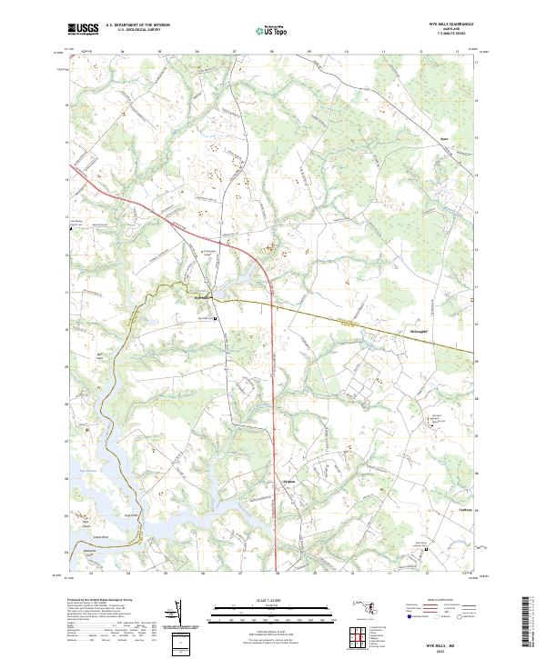 2023 Wye Mills2023 Print · USGSThe Queen Anne's and Talbot county line is defined by tidal rivers and farming communities in this recent survey. Researchers can trace family roots at John Wesley Church Cemetery or explore the landscape around Wye Mills and Chesapeake College.
 - 2023 Map of Ridgely, 2023 Print
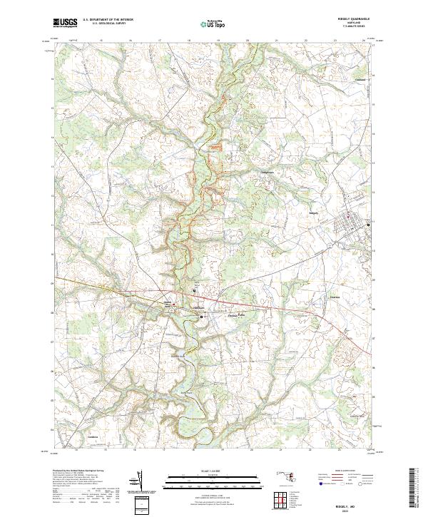 2023 Ridgely2023 Print · USGSThe Maryland Eastern Shore comes into focus in this contemporary study of the tri-county borderlands. Genealogists and local historians can trace family-named roads and landmarks from Hillsboro to Oakland, including Saint Pauls Episcopal Cem and Tuckahoe Neck.
 - 2023 Map of Fowling Creek, 2023 Print
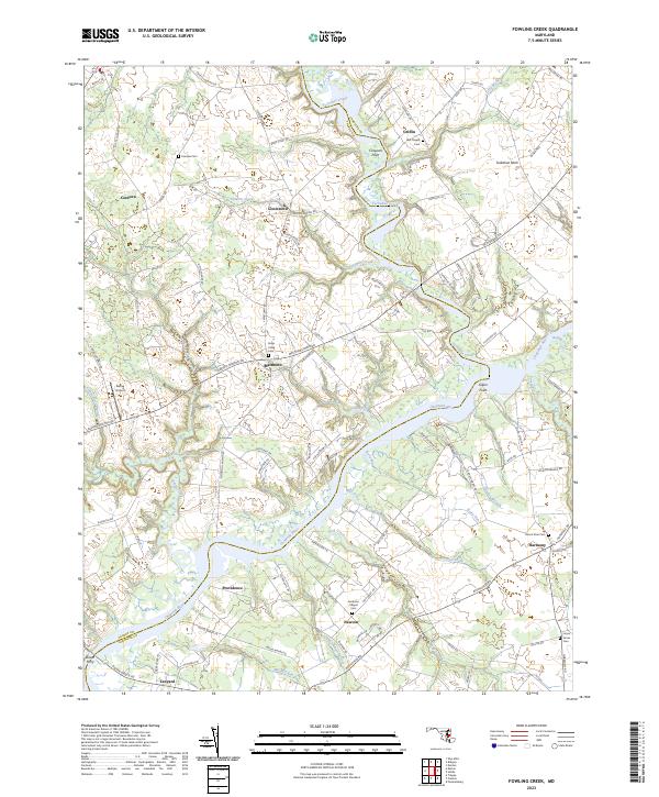 2023 Fowling Creek2023 Print · USGSMaryland's Eastern Shore comes to life in this recent survey of the tidal lands between the Choptank River and Tuckahoe Creek. Local historians can trace old community ties through sites like Dover Ferry, Smithson Chapel, and the Union Grove Cem at Harmony.
 - 2023 Map of East New Market, 2023 Print
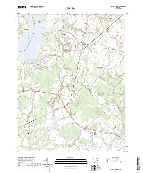 2023 East New Market2023 Print · USGSThe Dorchester County shoreline and inland farming communities are mapped in detail here as they appear today. Genealogists can locate family landmarks like East New Market Cem or trace the Maryland and Delaware RR past Linkwood and Hicksburg.
 - 2023 Map of Kent Island, 2023 Print
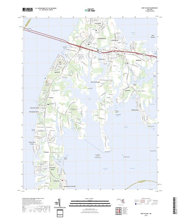 2023 Kent Island2023 Print · USGSKent Island at the modern turn of the century shows a landscape where historic crossroads like Stevensville meet growing bay-side communities. Genealogists and local historians can trace family sites at Wesley Cem and Kingsley Church Cem or explore the waterfront reaches of Batts Neck and Romancoke.
 - 2023 Map of Chesapeake Bay 1 (All Water), 2023 Print
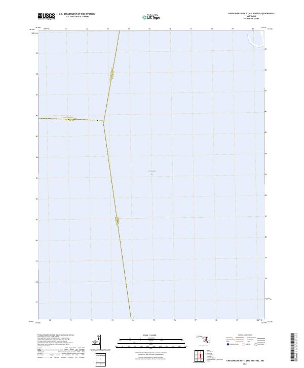 2023 Chesapeake Bay 1 (All Water)2023 Print · USGSMaryland's maritime interior is defined by these mid-bay county borders at the start of the 2020s. Genealogists and historians can trace the precise water boundaries of Anne Arundel, Talbot, and Calvert counties across the Chesapeake Bay.
 - 2023 Map of Chesapeake Bay 2 (All Water), 2023 Print
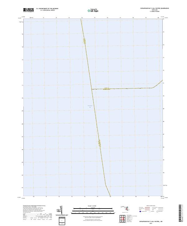 2023 Chesapeake Bay 2 (All Water)2023 Print · USGSThe open waters of the mid-bay take center stage in this recent maritime survey of the Maryland coast. Historians and researchers can trace the precise aquatic boundaries where Talbot Co, Calvert Co, and Dorchester Co meet in the Chesapeake Bay.
 - 2023 Map of Hudson, 2023 Print
 2023 Hudson2023 Print · USGSThe Eastern Shore of Dorchester County appears here as a complex network of peninsulas and bays in the early twenty-first century. Researchers can trace family history at the Spedden Seward Cem or locate rural infrastructure like Big Oak Farm Airport and Hudson School Rd.
 - 2023 Map of Cambridge, 2023 Print
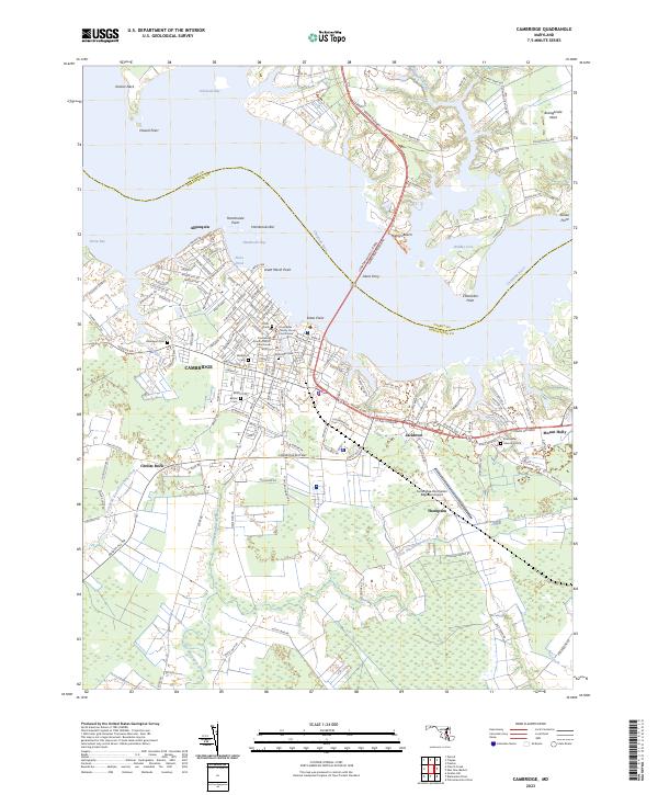 2023 Cambridge2023 Print · USGSMaryland's Eastern Shore center of Cambridge is captured in the early twenty-first century, showing its deep-water riverfront and expanding residential footprint. Genealogists and local historians can trace family plots at Cambridge Cem or explore the points along Hambrooks Bay and Jacktown.
 - 2023 Map of Preston, 2023 Print
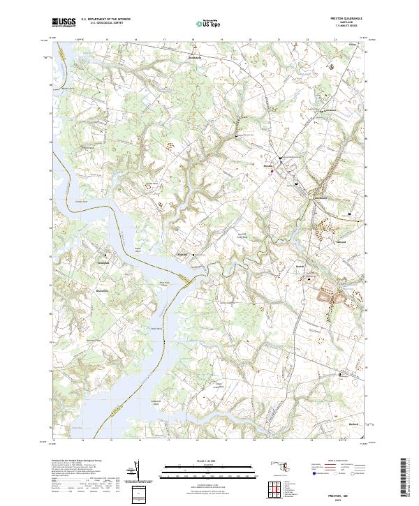 2023 Preston2023 Print · USGSThe winding Choptank River and its intricate tidal necks define this Eastern Shore landscape during the early twenty-first century. Genealogists and local historians can trace family ties through sites like Coppins Chapel, Barkers Ferry, and the Eastern Shore Veterans Cem.
 - 2023 Map of Oxford, 2023 Print
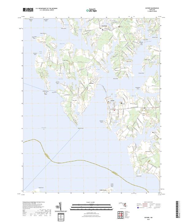 2023 Oxford2023 Print · USGSCoastal Talbot County in the 2020s remains deeply tied to its tidal geography and colonial-era settlement patterns. Researchers can trace the long history of the Tred Avon River shoreline through landmarks like the Oxford-Bellevue Ferry and Old John Wesley Cem.
 - 2023 Map of Queenstown, 2023 Print
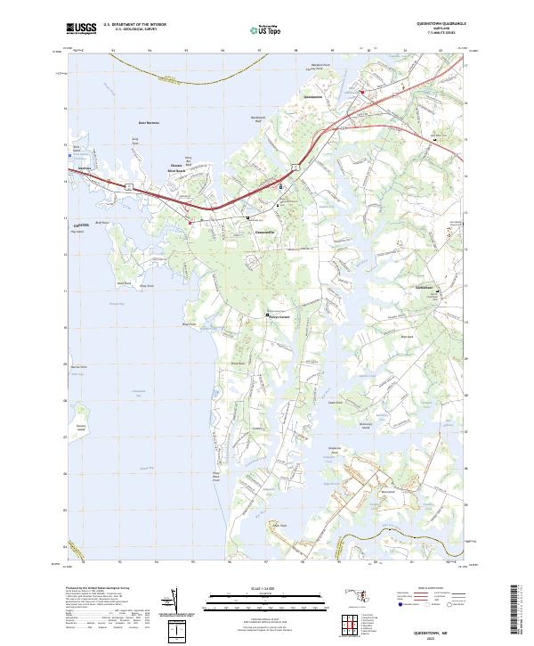 2023 Queenstown2023 Print · USGSThe Queen Anne’s County shoreline is captured here in detail, showcasing the maritime settlements and inlets of the Chesapeake Bay. Genealogists can locate family landmarks such as Saint Peters Cem, Grasonville Cem, and Bryan Methodist Church.
 - 2023 Map of Easton, 2023 Print
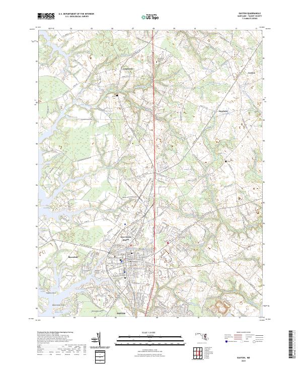 2023 Easton2023 Print · USGSCoastal Talbot County in 2023 shows a landscape shaped by the Tred Avon River and the enduring footprint of Easton. Researchers can trace local lineage through the Third Haven Meeting Burial Ground or explore the geography of Edmundson Neck and Easton Point.
 - 2023 Map of Deale OE E, 2023 Print
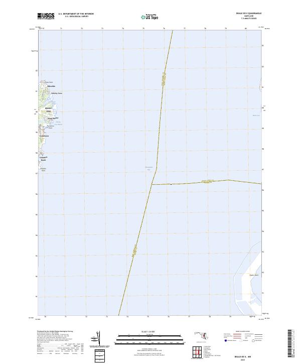 2023 Deale OE E2023 Print · USGSThe western shore of the Chesapeake Bay near Shady Side is shown here in the early 2020s. Genealogists and local historians can trace the modern layout of waterfront communities like Columbia Beach, Snug Harbor, and Idlewilde.
 - 2023 Map of Trappe, 2023 Print
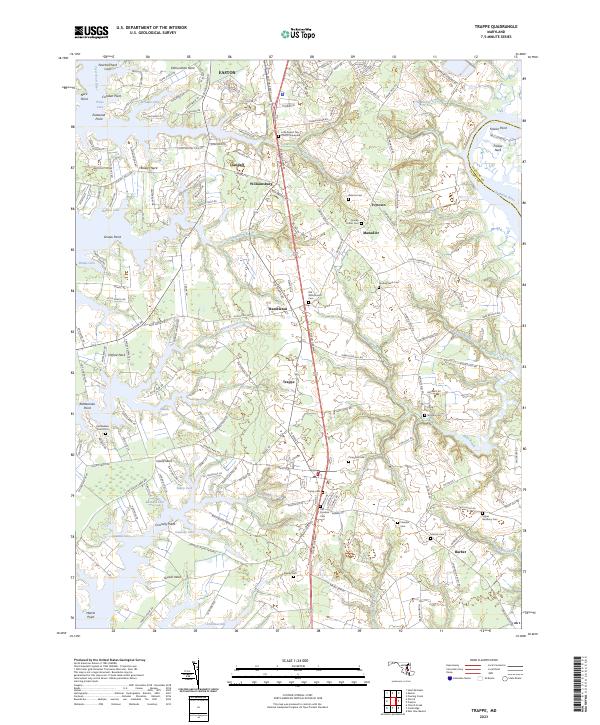 2023 Trappe2023 Print · USGSThe Eastern Shore of Maryland in 2023 reveals a landscape where historic crossroads and waterfront necks endure alongside modern thoroughfares. Researchers can trace family history through local landmarks like Old Whitemarsh Cem, Ivytown, and Little Round Top Church Graveyard.
 - 2023 Map of Tilghman, 2023 Print
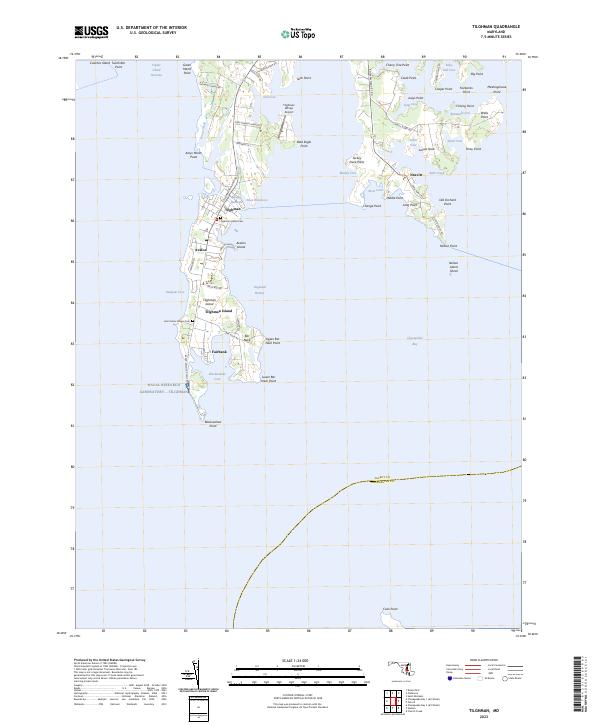 2023 Tilghman2023 Print · USGSCoastal Talbot County is mapped here in its contemporary state, showing the intricate island and peninsula communities of the Chesapeake. Genealogists can trace family sites at Saint Johns Chapel Cem and explore the historic water-bound settlements of Fairbank and Neavitt.
 - 2023 Map of Saint Michaels, 2023 Print
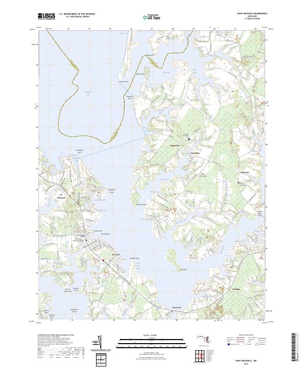 2023 Saint Michaels2023 Print · USGSThe Eastern Shore of Maryland comes into sharp focus during the 2020s, showing the complex coastline of Talbot County. Genealogists and historians can trace family locations near St. Michaels, Saint Stephens Graveyard, and the historic Miles River Ferry.
 - 2023 Map of Church Creek, 2023 Print
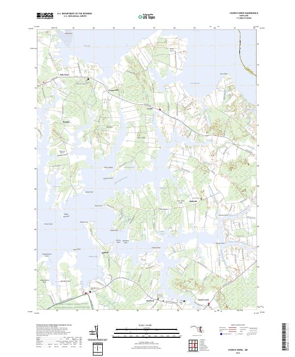 2023 Church Creek2023 Print · USGSDorchester County's tidal peninsulas are mapped here in the early twenty-first century, showing the intersection of coastal history and conservation. You can locate family burial sites at Old Trinity Cem or trace the boundaries of the Harriet Tubman Underground Railroad National Historical Park.
 - 2023 Map of Claiborne, 2023 Print
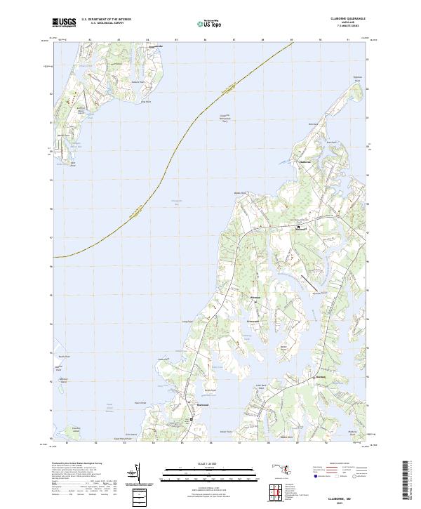 2023 Claiborne2023 Print · USGSThe Eastern Shore and Kent Island are captured in this modern survey of Maryland's tidewater settlements and maritime routes. Genealogists and historians can trace the connection of the Claiborne-Romancoke Ferry and locate local landmarks like Saint James Cem and the John Wesley Methodist Church.
End of results
Showing maps 1-19 of 19
Top cities of Talbot County
Frequently asked questions
- What are the different types of historical maps available for Talbot County?
- What is the oldest map of Talbot County?
- Where can I purchase historical maps of Talbot County for my home or office?
- Where can I download high-res historical maps of Talbot County?
- Are there historical topographic maps available for Talbot County?
- Is there historical aerial imagery available for Talbot County?
- Where are historical maps of Talbot County sourced from?