Old Maps of Talbot County, Maryland for Genealogy
Trace your family roots with 75 historic maps of Talbot County. These high-res maps reveal old neighborhoods, homesites, landmarks, and streets — helping you uncover where your ancestors lived and how the area evolved over time.
- Explore historic neighborhoods: Identify where your relatives may have lived in the 1800s or 1900s.
- Compare maps over time: Trace the changes in streets, buildings, and landmarks for multi-generational research.
- Perfect for genealogy & ancestry research: Used by family historians and researchers to map out lineage and migration.
These maps are an incredible resource for exploring your personal connection to Talbot County's past.
Talbot County, MD maps
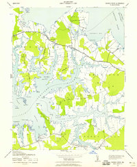
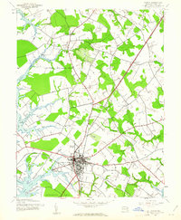
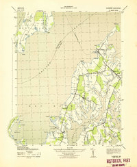
(75)- 1892 Map of Annapolis
 1892 Annapolis1892 Print · USGSCovers Talbot County, including Annapolis, Stevensville, and other nearby areas2 unique versions available
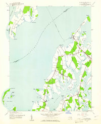
 - 1893 Map of Sharps Island
 1893 Sharps Island1893 Print · USGSCovers Talbot County, including Seaview, Hudson, and other nearby areas3 unique versions available
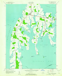
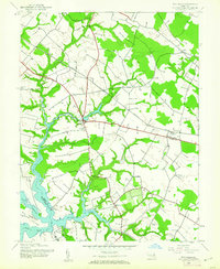
 - 1898 Map of Choptank
 1898 Choptank1898 Print · USGSCovers Talbot County, including Annapolis, Easton, and other nearby areas2 unique versions available
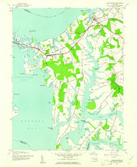
 - 1904 Map of St. Michaels
 1904 St. Michaels1904 Print · USGSCovers Talbot County, including Easton, Grasonville, and other nearby areas3 unique versions available
 - 1904 Map of Annapolis
 1904 Annapolis1904 Print · USGSCovers Talbot County, including Annapolis, Stevensville, and other nearby areas5 unique versions available
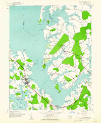
 - 1904 Map of Sharps Island
 1904 Sharps Island1904 Print · USGSCovers Talbot County, including Seaview, Hudson, and other nearby areas3 unique versions available
 - 1904 Map of Oxford
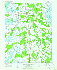
 1904 Oxford1904 Print · USGSCovers Talbot County, including Easton, Cambridge, and other nearby areas3 unique versions available
 - 1905 Map of Denton
 1905 Denton1905 Print · USGSCovers Talbot County, including Denton, Greensboro, and other nearby areas3 unique versions available
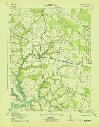
 - 1905 Map of Hurlock
 1905 Hurlock1905 Print · USGSCovers Talbot County, including Federalsburg, Hurlock, and other nearby areas3 unique versions available
 - 1908 Map of Choptank
 1908 Choptank1908 Print · USGSCovers Talbot County, including Annapolis, Easton, and other nearby areas5 unique versions available
 - 1942 Map of Tilghman
 1942 Tilghman1942 Print · USGSCovers Talbot County, including Deep Harbour Farm Estates, Neavitt, and other nearby areas3 unique versions available
 - 1942 Map of Oxford
 1942 Oxford1942 Print · USGSCovers Talbot County, including Oxford, Royal Acres, and other nearby areas3 unique versions available
 - 1942 Map of Church Creek, 1958 Print
 1942 Church Creek1958 Print · USGSCovers Talbot County, including Church Creek, Seawilde, and other nearby areas2 unique versions available
 - 1942 Map of Claiborne, 1961 Print
 1942 Claiborne1961 Print · USGSCovers Talbot County, including Claiborne, Mount Pleasant, and other nearby areas4 unique versions available
 - 1942 Map of Kent Island, 1961 Print
 1942 Kent Island1961 Print · USGSCovers Talbot County, including Stevensville, Chester, and other nearby areas3 unique versions available
 - 1942 Map of Queenstown, 1961 Print
 1942 Queenstown1961 Print · USGSCovers Talbot County, including Grasonville, Queenstown, and other nearby areas3 unique versions available
 - 1942 Map of Easton, 1961 Print
 1942 Easton1961 Print · USGSCovers Talbot County, including Easton, Longwoods, and other nearby areas3 unique versions available
 - 1942 Map of Wye Mills, 1961 Print
 1942 Wye Mills1961 Print · USGSCovers Talbot County, including Wye Mills, Starr, and other nearby areas2 unique versions available
 - 1942 Map of Sharps Island, 1961 Print
 1942 Sharps Island1961 Print · USGSCovers Talbot County, including Seaview, Hudson, and other nearby areas
 - 1942 Map of St. Michaels, 1961 Print
 1942 St. Michaels1961 Print · USGSCovers Talbot County, including Saint Michaels, Rays Point, and other nearby areas3 unique versions available
 - 1942 Map of Trappe, 1962 Print
 1942 Trappe1962 Print · USGSCovers Talbot County, including Easton, Trappe, and other nearby areas3 unique versions available
 - 1943 Map of Claiborne
 1943 Claiborne1943 Print · USGSCovers Talbot County, including Claiborne, Mount Pleasant, and other nearby areas
 - 1943 Map of Sharps Island
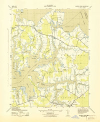
 1943 Sharps Island1943 Print · USGSCovers Talbot County, including Seaview, Hudson, and other nearby areas
 - 1943 Map of Wye Mills
 1943 Wye Mills1943 Print · USGSCovers Talbot County, including Wye Mills, Starr, and other nearby areas
 - 1943 Map of Church Creek
 1943 Church Creek1943 Print · USGSCovers Talbot County, including Church Creek, Seawilde, and other nearby areas
Showing maps 1-25 of 75
Top cities of Talbot County
Frequently asked questions
- What are the different types of historical maps available for Talbot County?
- What is the oldest map of Talbot County?
- Where can I purchase historical maps of Talbot County for my home or office?
- Where can I download high-res historical maps of Talbot County?
- Are there historical topographic maps available for Talbot County?
- Is there historical aerial imagery available for Talbot County?
- Where are historical maps of Talbot County sourced from?