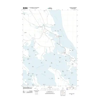
2011 Map of Eastport
USGS Topo · Published 2011About this map
Cobscook Bay and Passamaquoddy Bay dominate this easternmost coastal landscape, where a complex network of peninsulas and islands defines the Downeast shoreline. This 2011 survey captures the settlement of Perry and the community at Pleasant Point, situated along the narrow channel connecting the two bays. The map reveals the critical infrastructure of the region, from the Eastport Municipal Airport on the mainland to the inland waters of Boyden Lake, which feeds into the Boyden Stream Reservoir via the Boyden Lake Dam. Farther south, the tidal reach extends into South Bay, wrapping around the prominent landmass of Seward Neck. Navigational hazards such as Gangway Ledge and Wilson Ledges are clearly marked, illustrating the maritime character of a region where the land and sea are inextricably linked.
Find a feature on this map
90 named features on this map. Tap any name to fly to it.
Don’t see what you’re looking for? This feature index may not catch every label — zoom into the map to look around manually.
Map Details
Editions of this 2011 Eastport Map
This is the sole edition of this map. No revisions or reprints were ever made.
Other maps of this area

1907 · Eastport
USGS Topo · 1:48,000

1908 · Eastport
USGS Topo · 1:62,500

1929 · Robbinston
USGS Topo · 1:48,000

1931 · Robbinston
USGS Topo · 1:62,500

1943 · Eastport
USGS Topo · 1:62,500

1945 · Eastport
USGS Topo · 1:62,500

1949 · Robbinston
USGS Topo · 1:24,000

1949 · Whiting
USGS Topo · 1:24,000

1949 · Pembroke
USGS Topo · 1:24,000

1949 · Red Beach
USGS Topo · 1:24,000