
1949 Map of Red Beach
USGS Topo · Published 1952About this map
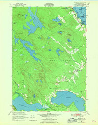
The St Croix River defines the eastern boundary of this coastal Washington County landscape, where the settlement of Red Beach sits at the water's edge. The interior is a complex network of freshwater bodies and wetlands, including the expansive Nashs Lake and Boyden Lake. The presence of the Moosehorn National Wildlife Refuge underscores the undeveloped nature of the terrain, which is dominated by low peaks like Howard Lake Mtn and Trimble Mtn. In the southern reaches, the settlement of Charlotte and the ridge community at South Robbinston Ridge provide evidence of local centers of gravity. Genealogists and local historians can pinpoint critical community landmarks such as the South Robbinston Ridge Sch, the Robbinston Ridge Ch, and the nearby Fairview Cem, all situated along the primary thoroughfare connecting these rural townships during the late 1940s.
Find a feature on this map
53 named features on this map. Tap any name to fly to it.
Don’t see what you’re looking for? This feature index may not catch every label — zoom into the map to look around manually.
Map Details
Editions of this 1949 Red Beach Map
3 editions found
Other maps of this area

1907 · Eastport
USGS Topo · 1:48,000

1908 · Eastport
USGS Topo · 1:62,500

1929 · Calais
USGS Topo · 1:48,000

1929 · Robbinston
USGS Topo · 1:48,000

1931 · Robbinston
USGS Topo · 1:62,500

1932 · Calais
USGS Topo · 1:62,500

1941 · Gardner Lake
USGS Topo · 1:62,500

1943 · Gardner Lake
USGS Topo · 1:62,500

1943 · Eastport
USGS Topo · 1:62,500

1945 · Eastport
USGS Topo · 1:62,500