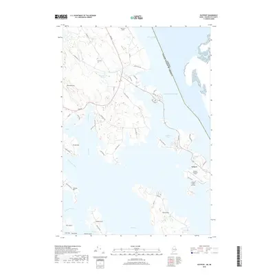
2018 Map of Eastport
USGS Topo · Published 2018About this map
Eastport anchors this coastal landscape where the Atlantic Ocean meets the complex inlets of eastern Maine. The map details a jagged shoreline defined by massive landforms like Seward Neck, Leighton Neck, and Denbow Neck, all separated by tidal waters including Sipp Bay and Half Moon Cove. The international boundary with Canada runs through Passamaquoddy Bay, highlighting the area's strategic maritime position. Local infrastructure is represented by the Eastport Municipal Airport and the Westlawn Institute of Marine Technology, reflecting a modern economy tied to both aviation and the sea. Inland, the terrain rises toward Porcupine Mtn, while the Leland Cem and numerous named roads like Old Eastport Rd offer touchpoints for local historians tracing family roots in this corner of Washington County.
Find a feature on this map
57 named features on this map. Tap any name to fly to it.
Don’t see what you’re looking for? This feature index may not catch every label — zoom into the map to look around manually.
Map Details
Editions of this 2018 Eastport Map
This is the sole edition of this map. No revisions or reprints were ever made.
Other maps of this area

1907 · Eastport
USGS Topo · 1:48,000

1908 · Eastport
USGS Topo · 1:62,500

1929 · Robbinston
USGS Topo · 1:48,000

1931 · Robbinston
USGS Topo · 1:62,500

1943 · Eastport
USGS Topo · 1:62,500

1945 · Eastport
USGS Topo · 1:62,500

1949 · Robbinston
USGS Topo · 1:24,000

1949 · Whiting
USGS Topo · 1:24,000

1949 · Pembroke
USGS Topo · 1:24,000

1949 · Red Beach
USGS Topo · 1:24,000