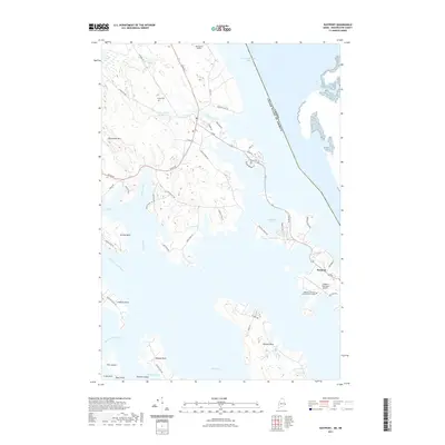
2021 Map of Eastport
USGS Topo · Published 2021About this map
Eastport sits at the maritime edge of Washington County, overlooking the international boundary between the United States and Canada. This 2021 survey illustrates a coastal landscape defined by irregular peninsulas such as Hersey Neck, Leighton Neck, and Seward Neck, which reach into the surrounding waters of Passamaquoddy Bay and Sipp Bay. The topography is a complex network of tidal inlets and freshwater systems, including the Pennamaquan River and the Boyden Stream Reservoir. Local infrastructure reflects the town's connection to the sea and sky, featuring the Westlawn Institute of Marine Technology and the Eastport Municipal Airport. Historical markers such as Leland Cemetery provide genealogical reference points, while roads like Old Toll Bridge Rd and River Rd trace the movement of people across this fractured shoreline.
Find a feature on this map
60 named features on this map. Tap any name to fly to it.
Don’t see what you’re looking for? This feature index may not catch every label — zoom into the map to look around manually.
Map Details
Editions of this 2021 Eastport Map
This is the sole edition of this map. No revisions or reprints were ever made.
Other maps of this area

1907 · Eastport
USGS Topo · 1:48,000

1908 · Eastport
USGS Topo · 1:62,500

1929 · Robbinston
USGS Topo · 1:48,000

1931 · Robbinston
USGS Topo · 1:62,500

1943 · Eastport
USGS Topo · 1:62,500

1945 · Eastport
USGS Topo · 1:62,500

1949 · Robbinston
USGS Topo · 1:24,000

1949 · Whiting
USGS Topo · 1:24,000

1949 · Pembroke
USGS Topo · 1:24,000

1949 · Red Beach
USGS Topo · 1:24,000