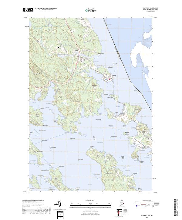
2024 Map of Eastport
USGS Topo · Published 2024About this map
Passamaquoddy Bay and the international boundary with Canada define the coastline of this eastern Washington County region. The community of Perry serves as a northern hub, situated near the Boyden Stream Reservoir and the Leland Cem. To the south, the city of Eastport occupies a prominent position on the shoreline, supported by the Eastport Municipal Airport and the Westlawn Institute of Marine Technology. The landscape is deeply indented by tidal waters including Cobscook Bay and Sipp Bay, creating numerous peninsulas such as Leighton Neck and Hersey Neck. Conservation land is central to the area, with portions of the Petit Manan National Wildlife Refuge protecting islands like Spectacle Island and Goose Island. The proximity to the international border in the Western Passage underscores the strategic maritime geography of this coastal frontier.
Find a feature on this map
125 named features on this map. Tap any name to fly to it.
Don’t see what you’re looking for? This feature index may not catch every label — zoom into the map to look around manually.
Map Details
Editions of this 2024 Eastport Map
This is the sole edition of this map. No revisions or reprints were ever made.
Other maps of this area

1907 · Eastport
USGS Topo · 1:48,000

1908 · Eastport
USGS Topo · 1:62,500

1929 · Robbinston
USGS Topo · 1:48,000

1931 · Robbinston
USGS Topo · 1:62,500

1943 · Eastport
USGS Topo · 1:62,500

1945 · Eastport
USGS Topo · 1:62,500

1949 · Robbinston
USGS Topo · 1:24,000

1949 · Whiting
USGS Topo · 1:24,000

1949 · Pembroke
USGS Topo · 1:24,000

1949 · Red Beach
USGS Topo · 1:24,000