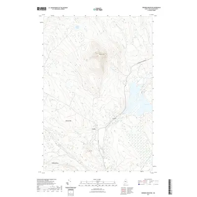
2021 Map of Ebeemee Mountain
USGS Topo · Published 2021About this map
Ebeemee Mtn anchors this central Maine landscape, a region defined by complex drainage patterns and scattered rural settlements in the early twenty-first century. The terrain transitions from the high peaks down into extensive wetlands such as Beaver Bogs and Orson Bog, reflecting the glacial legacy of the North Woods. Small communities like Mooresville, Prairie, and Williamsburg are linked by local connectors such as Davis St, while the Horseback Millinocket Rd provides passage through the lowlands. Water bodies including Middle Branch Pond and West Pond are fed by numerous seasonal flows like Babel Brook and Stinking Brook. The map reveals a specific intersection of elevation and hydrography where the namesake Horseback landform guides the local road network through the surrounding marshlands.
Find a feature on this map
17 named features on this map. Tap any name to fly to it.
Don’t see what you’re looking for? This feature index may not catch every label — zoom into the map to look around manually.
Map Details
Editions of this 2021 Ebeemee Mountain Map
This is the sole edition of this map. No revisions or reprints were ever made.
Other maps of this area

1940 · Sebec
USGS Topo · 1:48,000

1943 · Sebec
USGS Topo · 1:62,500

1947 · Schoodic
USGS Topo · 1:62,500

1949 · Schoodic
USGS Topo · 1:62,500

1951 · Norcross
USGS Topo · 1:62,500

1952 · Jo-Mary Mountain
USGS Topo · 1:62,500

1954 · Millinocket
USGS Topo · 1:250,000

1958 · Millinocket
USGS Topo · 1:250,000

1960 · Millinocket
USGS Topo · 1:250,000
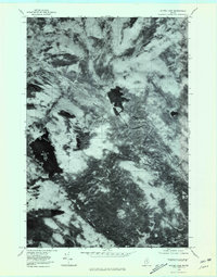
1978 · Silver Lake
USGS Topo · 1:24,000
Featured Places
- Brownville, ME
- Mooresville, Katahdin Iron Works Township
- Williamsburg Township, ME
- Ebeemee Township, ME
- TB R10 WELS, ME